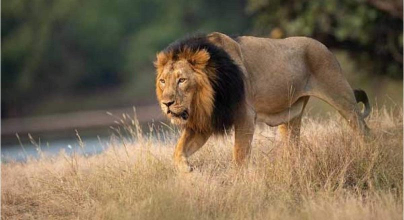
Nestled in the state of Gujarat in western India, the Gir Forest is the last bastion of the majestic Asiatic lion. The forest echoes the roars of these big cats and is home to a diverse and thriving ecosystem, boasting 338 bird species, 41 mammal species, 47 reptile species, and more than 631 types of flora. Within this vibrant ecosystem, the Asiatic lion stands as a symbol of successful conservation, representing a unique story of ecological preservation against many odds.
As the Divisional Forest Officer of Gir, IFS officer Mohan Ram is at the forefront of this effort, harnessing cutting-edge technology to ensure that Gir remains a safe haven for its wildlife.
“Conservation in today’s world cannot rely solely on traditional methods,” says Mr. Ram. “In a dynamic landscape like Gir, where human-wildlife interactions and ecological complexities are ever-evolving, technology provides us with the tools to understand, monitor, and protect this unique habitat more effectively.”
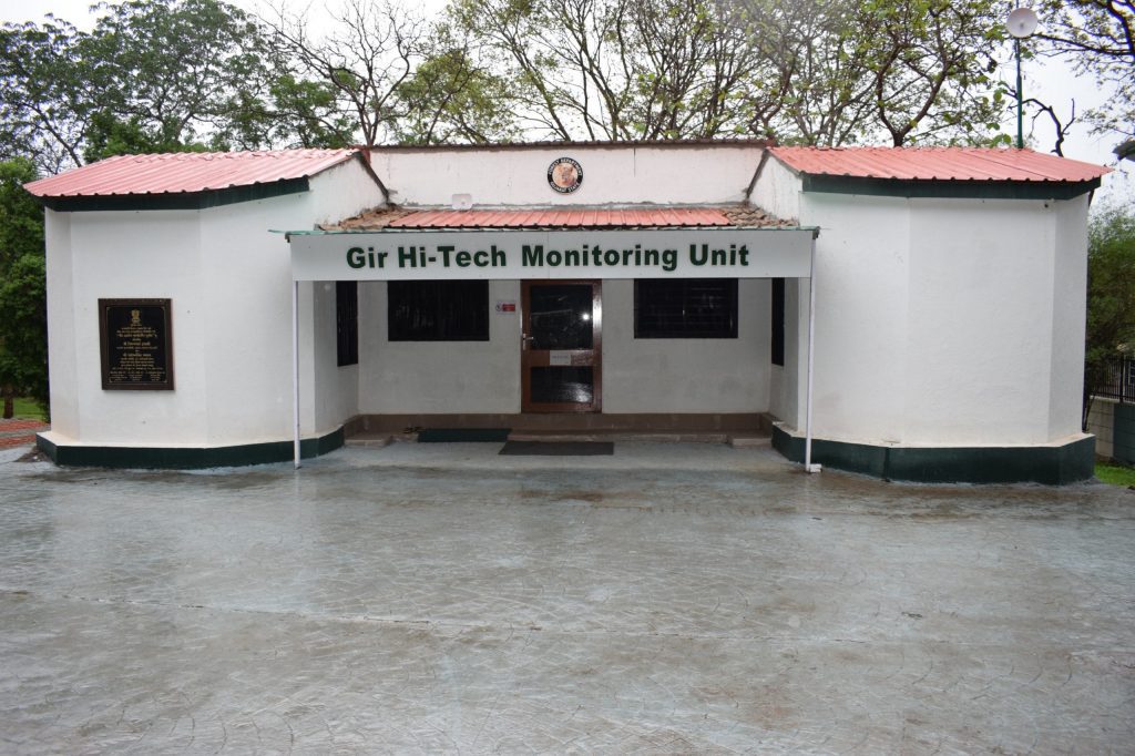
A HIGH-TECH HUB IN THE HEART OF THE FOREST
To navigate the complexities of wildlife conservation, the Gujarat Forest Department established the Gir Hi-Tech Monitoring Unit in 2019. This state-of-the-art facility in Sasan-Gir represents the nerve center of the forest’s technological monitoring and management.
Divided into three distinct units, the center uses advanced technology to study and protect the park’s inhabitants, including the majestic lions and their surrounding ecosystem. This initiative includes radio-telemetry studies on carnivores and birds, CCTV surveillance at critical points, and a comprehensive safari vehicle surveillance system.
“Through scientific monitoring and data analysis, we can make informed decisions that directly contribute to the conservation and management of the wildlife here. It’s a knowledge-based approach that addresses the challenges posed by urbanization, human-wildlife conflict, and the growing tourist influx,” he told Indian Masterminds.
ENHANCING ECOTOURISM THROUGH TECHNOLOGY
Gir attracts around eight lakh visitors annually, each hoping to catch a glimpse of the elusive Asiatic lion. Managing such a large number of tourists while minimizing the impact on the forest ecosystem is a delicate balance. To tackle this, the park introduced the Safari Vehicle Surveillance System. This system tracks safari vehicles, ensuring they adhere to their designated routes and follow the park’s rules.
The surveillance data—monitoring instances like over-speeding, off-route driving, and unauthorized stoppages—helps the park management to address any operational issues promptly. Moreover, this data is analyzed to improve ecotourism practices, ensuring a safer and more enjoyable experience for visitors while safeguarding the environment.
“Our goal is to foster a visitor-centric approach that doesn’t compromise conservation efforts. Technology allows us to monitor and manage the ecotourism flow in real-time, reducing human impact on the habitat,” he shared.
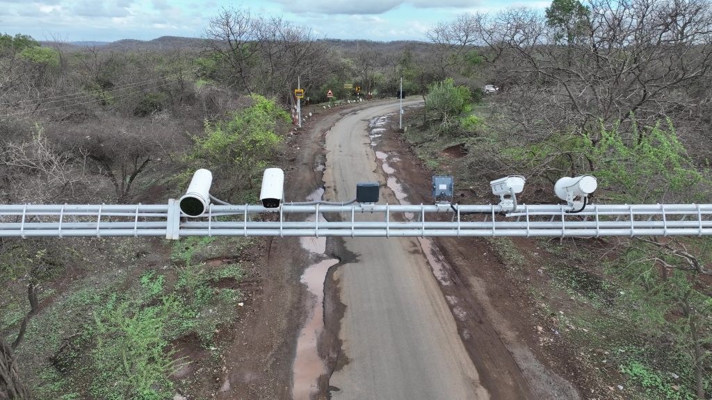
FORTIFYING THE FOREST BORDERS WITH SURVEILLANCE
Securing Gir’s vast expanse from intrusions and poaching is a critical task. To enhance the forest’s protection, a sophisticated CCTV Surveillance System has been deployed at key entry and exit points. Equipped with Automatic Number Plate Recognition (ANPR) technology, modern cameras continuously monitor both vehicles and individuals. This provides immediate oversight and creates an archive of valuable data for post-event analysis.
“Real-time surveillance acts as both a deterrent and an investigative tool. It allows us to respond promptly to unauthorized activities and analyze patterns that could inform future conservation strategies,” he told Indian Masterminds.

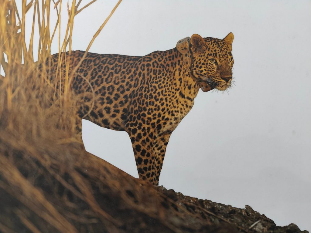
REVOLUTIONIZING CARNIVORE CONSERVATION WITH TELEMETRY
In a pioneering move, the Gujarat Forest Department has adopted advanced satellite radio-collar technology to monitor the movement of Asiatic lions and Indian leopards. Sourced from Germany, satellite radio collars were deployed on selected individuals.
This revolutionary initiative enables the systematic collection of data about the ecology of these carnivores, including spatial distribution, corridor usage, habitat preferences, and seasonal migration patterns.
“These radio collars give us an unprecedented insight into the lives of these big cats. We can monitor their movements in real-time, receive alerts about potential conflicts, and take proactive measures to ensure their safety and that of the local communities.”
EXPLORING THE SKIES OF GIR
Gir is not just the realm of lions; it is a sanctuary for a rich diversity of birdlife. The avian telemetry system, using solar-powered transmitters, monitors 16 bird species across the landscape, including vultures, eagles, cranes, and lesser flamingos. By collecting data on their migration patterns, foraging habits, and breeding grounds, this initiative reveals previously unknown aspects of these species’ ecology.
“The data obtained from avian telemetry helps us understand the broader ecological interactions within Gir. It informs habitat management decisions and ensures that our conservation strategies are holistic, encompassing all facets of the ecosystem,” shared Mr. Ram.
PREVENTING CONFLICTS AND CASUALTIES
One of the most crucial aspects of wildlife management is minimizing human-wildlife conflict. Gir’s Alert Generation System plays a vital role in this, delivering timely information to frontline staff for immediate field intervention. It generates alerts based on the movement patterns of radio-collared animals, indicating when they are nearing human habitations, traversing conflict zones, or exhibiting restricted movements.
“These alerts act as an early warning system. By notifying field staff in real-time, we can respond quickly to prevent conflicts, reduce wildlife mortalities, and ensure the safety of both animals and people.”

DIGITAL CONNECTIVITY IN THE WILDERNESS
The expansive and rugged terrain of Gir requires reliable communication among field staff. To facilitate this, a specialized wireless communication system has been established, equipped with digital hand-held radios and fixed vehicle sets. Repeater stations strategically placed throughout the forest ensure seamless connectivity across the landscape, even in the remotest areas.
“Effective communication is the backbone of field operations. With this system, our teams can coordinate more effectively, ensuring rapid response to any emerging situations.”
IDENTIFYING THE KING OF THE JUNGLE
Identifying individual lions has traditionally been challenging, as these cats lack distinctive color patterns. However, each lion has a unique vibrissae pattern—rows of whisker spots on either side of their muzzle. Leveraging this unique identifier, the AI-based software SIMBA was developed to automatically identify individual lions using deep machine learning techniques.
“SIMBA has transformed how we monitor the lion population. By matching whisker spot patterns, facial scars, and ear notches, the software helps us build a comprehensive database of individual lions, contributing significantly to our research and conservation efforts,” he told Indian Masterminds.
E-GUJFOREST
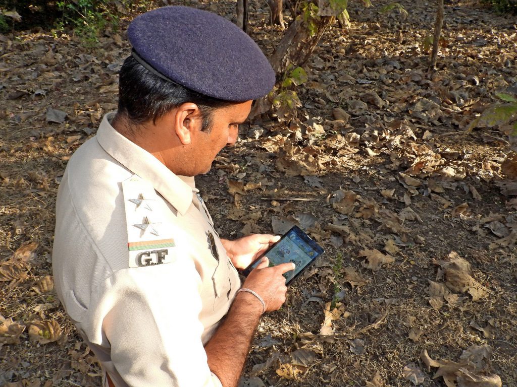
The Forest Management Information System (FMIS), known as E-GujForest, is a game-changer in forest management. This Android-based application enables field staff to record a wide range of data, from forest offenses to wildlife observations, even in areas without GSM network coverage.
The system’s integration with GIS mapping enhances data analysis, helping the forest department to formulate more effective protection and management strategies.
“E-GujForest empowers our field staff with the tools they need to capture and analyze data efficiently. It’s a comprehensive platform that enhances our ability to manage the landscape more effectively.”
MAPPING THE PATH TO CONSERVATION
GIS technology forms the backbone of data integration and analysis in Gir. The GIS Cell employs software like ArcMap and QGIS for habitat mapping, corridor delineation, species distribution modelling, and more. The data generated by these systems informs a wide range of conservation activities, from optimizing patrolling routes to prioritizing conservation areas.
“GIS allows us to visualize complex ecological data and understand the spatial dynamics of the landscape. It’s an essential tool in our decision-making process, helping us create effective management plans.”
ENSURING ROAD SAFETY
The forest’s proximity to human settlements poses another challenge: road accidents involving speeding vehicles. The Gir Speed Monitoring System employs sensor-based speed monitoring, ANPR, and thermal cameras to detect and track vehicles, alerting drivers about their speed and the presence of wildlife. This system not only prevents wildlife accidents on roads but also enhances overall road safety in the area.
“Wildlife corridors often intersect with roads, leading to potential conflicts,” he shared. “By monitoring and controlling vehicle speed, we can significantly reduce the risk of accidents, protecting both wildlife and human lives.”

A TECHNOLOGY-DRIVEN APPROACH
The technological advancements incorporated in Gir under the leadership of Mr. Ram represent a new era of conservation. From real-time telemetry and AI-based identification to digital field reporting and GIS mapping, these tools provide a multi-faceted approach to understanding and protecting the forest’s complex ecosystem.
Through his work, the officer exemplifies how a technology-driven, knowledge-based approach can lead to more effective conservation and management of wildlife.