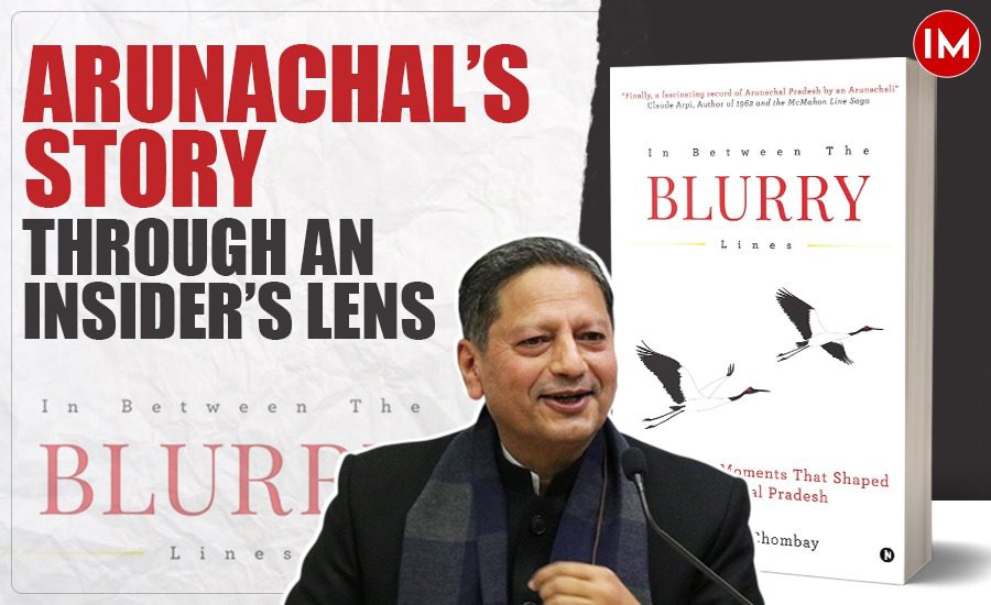
I must confess that if this book, as well as Ashish Kundra’s A Resurgent North East: Narratives of Change, had been available four years earlier, I would have been able to add greater heft to my chapter on the reorganization of the North East in my book We, The People of the States of Bharat: The Making and Remaking of India’s Internal Boundaries. The positive point to note is that scholarship in each of the states of the Northeast is now available in the public domain. Blurry Lines has the added advantage of an insider’s perspective who is deeply immersed in the development of the state as a civil servant with over two decades of experience – both in the field as well as the Secretariat and with Central governance institutions like the (erstwhile) Planning Commission, Finance Commission, and the Niti Ayog.
The book begins with a reflection on the Great Game – the Anglo-Russian-Chinese rivalry on control over Central Asia (and Tibet). Till the first quarter of the nineteenth century, the eastern Himalayas beyond the plains of Assam were considered ‘terra incognita,’ and even the Ahom kings thought it best to offer Posa (an allowance paid to the highlanders to desist from raids on settlements in the valley). It was only after the Treaty of Yandabo, in the aftermath of the Anglo-Burmese War from 1824-26, that the Governor-General of Bengal took over the administration of this area. The policy of leaving these areas as they were was formalized by the Bengal Eastern Frontier Regulations of 1873, which gave life to the concept of the Inner Line. But if there is an Inner Line, there has to be an Outer Line as well. The Viceroys – Curzon, Hardinge, and Minto – wanted to fix the external boundary beyond the very lightly administered buffer, primarily to secure their possessions from the other Imperial Powers. Curzon sanctioned the Younghusband expedition to Lhasa in 1904 to prevent the rooftop of the world from entering into the Russian orbit. Less than a decade later, the tottering Qing dynasty gave way to the (Nationalist) Republic of China in 1912, but in the political interregnum, the thirteenth Dalai Lama declared Tibet’s independence and sought the support of British India to demarcate not just its boundary with them, but also with China. Writes Chombay ‘The British, recognizing the strategic importance of stabilising the volatile Kham boundary, protecting the Assam Hinterlands, and establishing a buffer zone, were prepared to provide the necessary external support for these negotiations – which culminated in the now contested McMahon Line initialed by China, Tibet, and British India but signed only by India and Tibet in 1914 at Simla’ (as Shimla was then called). The McMahon Line itself was based on the 1,680-mile expedition of Frederick Bailey and Henry Morsehead in their search for the origin of the Tsangpo (Brahmaputra). The Convention accepted three points: the division of Tibet into Outer and Inner, Chinese suzerainty over the entirety of Tibet but with the provision that British India got free access to trade within the boundaries of Inner Tibet along with permission to keep troops in Lhasa, Yatung, Gyantse, and Gartok. The border of present-day Arunachal was established based on the watershed and the highest ridge principle, which gave India the regions of Tawang and Dirang Dzong. But the ‘buffer logic’ of British India kept roads, outposts, and physical infrastructure to the bare minimum. It was through this region that the famous botanist Frank Kingdon-Ward crossed over in search of his flora in Inner Tibet, thereby creating a diplomatic hiccup for his return. Later, in 1938, Captain G.S. Lightfoot travelled to Tawang to inform them that their (Monyul) territory was now under India and not Tibet. It took another thirteen years for Major Bob Khathing to fly the tricolour in Tawang on 9th February 1951 and formally establish the authority of India in this contested territory. But a few months before Khathing reached Tawang, a massive earthquake with a magnitude of 8.7 on the Richter scale had shaken the entire region, and the prompt action by the state machinery and civil society from across the nation convinced the populace that the new Republic ‘was a provider of tangible goods and benefits: a stark contrast from the coercive colonial military promenades and punitive expeditions.’
At Tawang, Khathing not only established an outpost for the Assam Rifles and the Political agency, but also a small dispensary for health check-ups and provided galvanized sheets for the roofing of the monastery, which had been damaged during the quake. He then undertook a sixteen-day tour to the Bum La and Tulung La ranges to demarcate the McMahon line on the ground and establish check posts at Bum La, Chutangmu, and Chuna. Neeru Nanda, in her book, reminisces that after Khathing had taken over Twang, the village elders insisted on paying some tax to the Indian government to mark the transition; thus came the annual tax of five rupees per household.
Then there is the discussion on Verrier Elwin and his ‘Philosophy for North East Frontier Agency (Nefa),’ the former name of the state. After his interaction with Mahatma Gandhi at the Sabarmati Ashram, Elwin gave up his missionary calling and spent a lifetime with the tribal population, first in Central India and then in NEFA. In his own words, ‘If we wish to serve, we must show that we have respect for the hillmen and their institutions, their language and their song, and in showing such respect, we shall secure their confidence in the work that lies ahead.’ However, post the 1962 war with China, ‘the ideals of autonomy and cultural respect gave way to a more assertive stance, with security at the borders taking precedence over anything else.’ Although Khathing had moved to Sikkim as the Development Commissioner, he was recalled as the Security Commissioner for NEFA and posted at Tezpur as the Chief Liaison officer with the rank of Brigadier to coordinate the operations with the IV Corps of the Army as well as the SSB. Together with Nari Rustomji, the Adviser to the Governor of Assam, they toured the forward areas, where, despite the angst over the retreating army, the atmosphere was one of absolute tribal allegiance towards India.
In the third and fourth sections of the book, Chombay tells us about the making of the state – a remarkable transition from a frontier tract to a modern state in the Union of India. Officers of the IFAS come in for a special recognition: Yusuf Ali, P.N. Luthra, KAA Raja, S.M. Krishnamatary, Takap Ringu, Matin Dai, Toyi Dai, and T.S. Deori – to name a few. IAS officers like Neeru Nanda, Prashant Lokhande, Ashish Kundra, and the author have carried forward this tradition. It also talks about NEFA getting the Indic identity of Arunachal, as well as the state anthem written and sung by the legendary Bhupen Hazarika. Of special interest are two full-length interviews with the first CM, Prem Khandu Thungon, and the current CM, Pema Khandu – these give us political insights into the making of the state.
The Epilogue is a bold, frank and fair assessment of thirteen key challenges and opportunities. But if we include his note on placing all of these in the national and global context then these become fourteen key takeaways to remove the blur from our understanding of this beautiful state.
We have thirty three pictures black and white pictures from the NEFA period, and thirty two colour pictures from the times when Arunachal Pradesh was a state. These include the presidential visits of His Holiness the 14th Dalai Lama, presidents Giani Zail Singh, Neelam Sanjiva Reddy, V.V. Giri, Ram Nath Kovind and Draupadi Murmu – Prime Ministers Indira Gandhi, Morarji Desai, Manmohan Singh and Narendra Modi – who has visited the state thrice (so far!). A picture is the equivalent of a thousand words, and each picture shows the transition from the times of Verrier Elwin to a state with a ‘state-of-the-art airport’ with night landing facilities!

