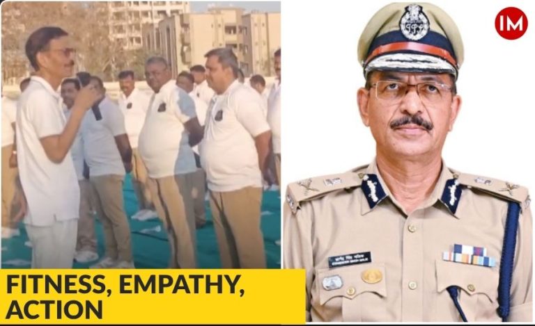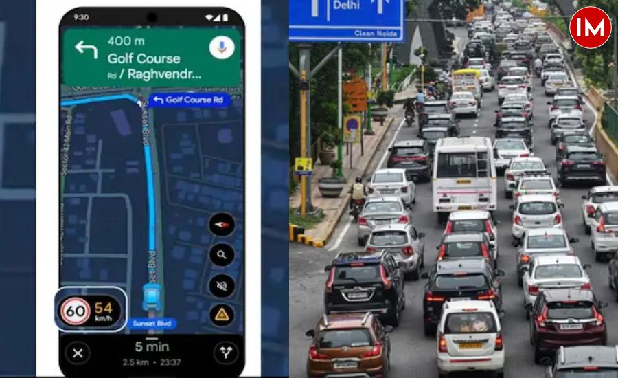
Noida has become the first district in Uttar Pradesh to introduce Google’s real-time Speed Limit integration on Maps—a move that could reshape how commuters interact with road safety. The initiative, driven by IPS Dr Rajeev Narain Mishra, Additional Commissioner of Police, Noida, brings official speed limits directly onto drivers’ navigation screens, allowing them to compare their driving speed with the permitted limit at any given moment.
A SIMPLE FIX TO A LONGSTANDING PROBLEM
Anyone who uses Google Maps knows that while the app shows how fast the vehicle is moving, it does not always show what the legal speed limit is. On Indian roads, the situation is even more complicated: boards are often missing, poorly placed, or outdated. For everyday drivers, this means they are often unaware of whether they are under-speeding, over-speeding, or simply guessing.
The new feature resolves this by placing two circles side by side on the Google Maps screen—one with the permitted speed and the other with the driver’s current speed. The idea is to combine technology with behavioural change.
In a conversation with Indian Masterminds Dr. Mishra explains the intent simply:
“When drivers can clearly see the allowed limit next to their own speed, the urge to correct themselves comes naturally. It turns navigation into a form of gentle guidance rather than enforcement.”
HOW THE PROJECT TOOK SHAPE
The project began when Dr. Mishra noticed that Noida’s traffic issues stemmed not just from violations but from a lack of uniform information for commuters. During his earlier tenure as SP Traffic, he had overseen key camera installations on the Noida–Greater Noida Expressway. This experience later helped him recognise how technology could be used more proactively.
He reached out to Google through the department’s strategic partnership wing, collaborated with Lepton Software for the technical groundwork, and coordinated data validation. A feature that functions so seamlessly on the front end required meticulous planning at the back end.
Reflecting on the process, Dr. Mishra notes:
“The real challenge was compiling accurate limits for every type of road—main corridors, service lanes, and internal links. These limits were set at different times by different authorities, so aligning them into a single verified dataset took patience.”
Where road limits conflicted or remained unclear, the police opted for the more conservative value to prioritise safety.
While Google has enabled similar features globally, rolling it out in India at the city level required initiative from local leadership. Noida was a compelling starting point due to its rapidly growing traffic density and complex road networks.
Dr. Mishra decided to take responsibility for spearheading the rollout.
“Traffic is a dynamic problem here,” he says. “If we want safer roads, waiting for perfect conditions is not an option. Sometimes, we have to begin with what is possible and improve as we go.”
AWARENESS AS THE NEXT TOOL OF ENFORCEMENT
Technology alone cannot change mindset, which is why Noida Police is running awareness drives among two-wheeler riders, delivery agents, school drivers, and local transport operators. The emphasis is not on punishment but on creating an environment where drivers instinctively match their behaviour with safe practices.
According to Dr. Mishra:
“When people witness preventable deaths on the roads, it stays with them. A small prompt on their screen can trigger the caution that saves a life. That is the larger purpose behind this project.”
He believes that combining information clarity with behavioural nudges will reduce reliance on manual enforcement and promote self-regulation.
NEXT PHASE
With the launch completed, the team is now working on mapping accident hotspots across Noida. Once verified, these will be reflected on Google Maps as well—alerting drivers in advance when they are entering a high-risk stretch.
The verification process, however, is multi-layered. The police identify the points, share the data, and Google conducts its own checks before updating the map. This ensures accuracy and avoids misinformation.
A MODEL FOR FUTURE TRAFFIC MANAGEMENT
The Google Speed Limit Project is a step toward making commuting safer through real-time information rather than penalties. It introduces accountability without confrontation and uses a platform people already rely on.
Noida now becomes a reference point for how Indian cities can leverage global technology to solve local problems. Under the leadership of IPS Dr. Rajeev Narain Mishra, the initiative has bridged a crucial information gap, encouraging responsible driving habits through transparency and convenience.
The Noida model stands ready to guide the way—proving that thoughtful digital interventions can influence behaviour as effectively as traditional enforcement, and sometimes more gently too.