Deep inside Udanti-Sitanadi Tiger Reserve, a remarkable ecological recovery is quietly unfolding – one that combines artificial intelligence, satellite monitoring, drone-based mapping, anti-poaching enforcement, and the lived knowledge of forest communities to bring back some of India’s rarest arboreal wildlife.
Species typically associated with the Western Ghats and parts of the Himalayas – such as the Malabar Giant Squirrel, Indian Giant Flying Squirrel and Malabar Pied Hornbill – are now expanding their presence across forest ranges in Chhattisgarh, signaling that a damaged habitat is beginning to heal.
At the centre of this transformation is a strategy led by 2017 batch Indian Forest Service (IFS) officer Varun Jain, who says the revival was never designed as a species-specific project. Instead, it emerged from a broader mission: restore forest integrity, remove encroachment, curb poaching, and rebuild ecological continuity.
What followed, however, has become one of the most striking examples of how AI-backed conservation can deliver measurable biodiversity gains in central India.
Indian Masterminds spoke with Mr Jain, Deputy Director of the Udanti-Sitanadi Tiger Reserve in Chhattisgarh, to understand the full scope of this initiative, the science behind the intervention, and how it is gradually transforming the forest landscape of Udanti-Sitanadi Tiger Reserve.
“When we started, our objective was simple – if encroachment is happening, it has to be removed; if poaching is happening, it has to be stopped. We did not initially imagine that these rare species would return in such numbers,” said Mr Jain.
Why these species matter: Rare wildlife that survives only in intact forest canopies
The return of these species is ecologically significant because all three depend on highly specific forest conditions.
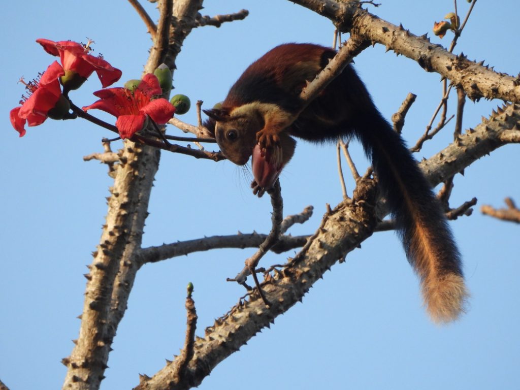
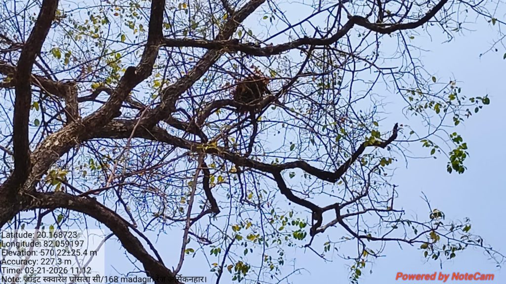
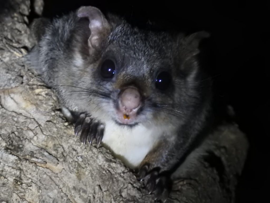
The Malabar Giant Squirrel and Indian Giant Flying Squirrel survive only where tree canopies remain continuously connected. Unlike common squirrels that frequently descend to the ground, these species move almost entirely through the upper forest layer—jumping or gliding from branch to branch through what forest ecologists call “arboreal highways.”
These interconnected canopy corridors act exactly like natural aerial transport routes. The moment canopy continuity breaks because of illegal tree felling, encroachment, road construction, or habitat fragmentation, the squirrels lose mobility, feeding access, breeding space, and protection from predators.
According to Varun Jain, this makes squirrel presence one of the clearest indicators of forest health.
If dense canopy exists, the species survives. If canopy fragments, the species disappears rapidly.
The Malabar Giant Squirrel, notably, is also the state animal of Maharashtra, making its strong population presence in Udanti especially significant.
Chhattisgarh’s forests as a hidden faunal bridge between major ecological zones
Although these species are strongly associated with the Western Ghats, their occurrence in Chhattisgarh is not accidental.
The Central Indian Highlands form a critical ecological bridge connecting the Western Ghats, the Eastern Ghats, and Himalayan landscapes. This “faunal bridge” allows certain rare species to extend their home ranges across connected forest belts.
Udanti-Sitanadi’s terrain helps explain why this reserve has emerged as a stronghold.
The reserve includes hill systems reaching nearly 1,000 metres, relatively cooler microclimates, perennial water sources, and tree species that closely resemble habitat conditions available in Western Ghats forests.
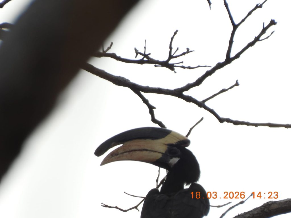
This explains why sightings of Malabar Pied Hornbills, Giant Squirrels, and Flying Squirrels are now more frequent here than in many surrounding landscapes.
While the same species are also found in places like Satpura Tiger Reserve and Pench Tiger Reserve, officials say the density of recent sightings in Udanti is unusually high.
The crisis in 2022: Encroachment, poaching and collapsing canopy cover
When Varun Jain arrived in the reserve, the situation was deeply concerning.
Large-scale encroachment had already altered forest patches. Illegal tree felling had broken canopy continuity. Poaching was widespread, especially because the reserve shares nearly 125 kilometres of forest border with Odisha.
Many rare arboreal species were hunted for bushmeat.
Flying squirrels were locally mistaken for ordinary rats—often called “flying moosa”—and killed for consumption. Hornbills were hunted for meat. Ground squirrels were targeted using slingshots.
Forest degradation had reached a point where some rare species were confined to only one or two small pockets.
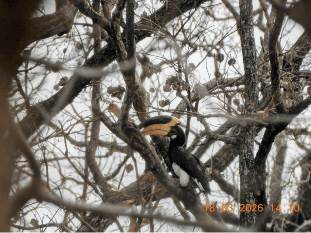
For Malabar Pied Hornbills, sightings were initially restricted to just one range: Kulhadighat.
How AI became the first line of forest diagnosis
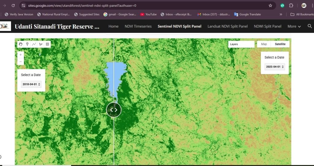
Beginning in 2022, the reserve administration started using a Google Earth Engine-based remote sensing portal to scientifically assess habitat degradation across the reserve’s 1,840 square kilometre landscape.
This system uses long-term satellite imagery from Sentinel and LANDSAT archives spanning nearly 15 years.
The portal compares historical and current forest conditions using:
- NDVI (Normalized Differential Vegetation Index)
- NDWI (Normalized Differential Water Index)
- AI and machine learning algorithms
- Canopy density analysis
- Surface water loss mapping
- Fragmentation detection
The system automatically highlights ecological stress zones—areas where canopy cover is shrinking, water bodies are drying, or fragmentation is increasing.
Instead of manually surveying the entire reserve with only 40% staffing strength, officials first identified red-flag hotspots digitally.
This drastically improved operational efficiency.
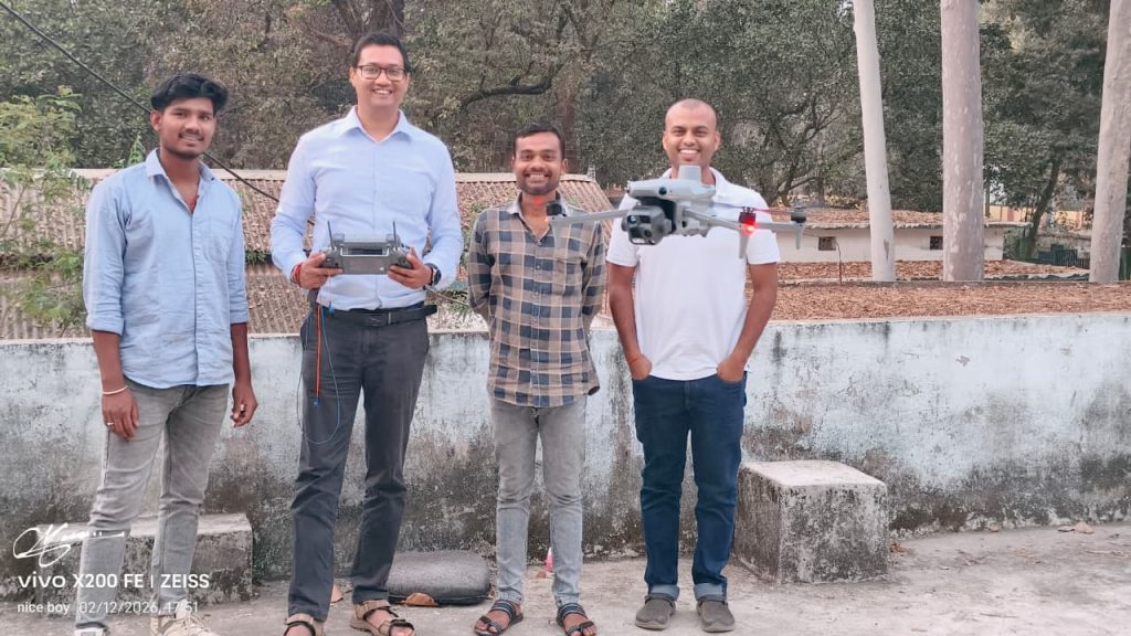
Drones verified what satellites detected
Once hotspot areas were identified through satellite analysis, survey-grade AI-powered drones were deployed for ground verification.
These drones generated high-resolution imagery of exact problem zones.
The drone mapping helped officials determine whether habitat decline was caused by:
- Encroachment
- Illegal logging
- New roads or infrastructure
- Surface water loss
- Forest gaps preventing canopy continuity
This high-resolution evidence directly guided field action.
850 hectares of encroachment removed and habitat reclaimed
One of the biggest interventions followed directly from hotspot identification.
Over three years, the reserve administration cleared 850 hectares of encroached forest land.
What made this intervention especially effective was what happened afterward.
Rather than leaving cleared land exposed, officials immediately began ecological restoration.
Rebuilding food forests: Why Ficus trees became central to recovery
Through field tracking and community observations, forest staff discovered that nearly 90% of hornbill sightings occurred around:
- Peepal
- Banyan
- Other Ficus species
The reason became clear.
Ficus species fruit throughout the year—summer, monsoon, and winter—making them reliable food sources when other trees fail seasonally.
This led to targeted plantation of:
- Peepal
- Banyan
- Jackfruit
- Bael
- Bamboo
- Bombax ceiba (Kapok)
- Other fruit-bearing native species
Gap plantations and block plantations were undertaken in degraded patches.
Bombax ceiba proved especially valuable because it fruits even during peak summer.
“Hornbill Restaurant”: A new conservation model rooted in food security for birds
One of the most innovative community-led interventions was named “Hornbill Restaurant.”
Inspired by the vulture restaurant concept used elsewhere in India, the idea was simple:
Create designated habitat patches rich in food-bearing trees where hornbills can reliably forage.
Using AI hotspot data, officials selected canopy-gap zones and former encroachment areas, then planted food species over roughly 200–250 hectares.
The result was both ecological and symbolic.
A landscape once hostile to hornbills became a feeding corridor.
“Weaving Back the Squirrel Canopies”: Restoring arboreal highways
For squirrel recovery, the focus remained on restoring continuous canopy.
Plantations were designed not merely as tree addition but as canopy-link restoration.
The goal was to reconnect fragmented treetop routes so squirrels could move range to range without descending to the ground.
This directly supported both Giant Squirrel and Flying Squirrel dispersal.
Water as habitat infrastructure: Solar pumps in drying ponds
AI analysis also revealed another hidden threat—summer water loss.
Though the reserve contains many ponds, only a small fraction retained water through March, April and May.
To address this, solar-powered pumps were installed in 21 identified ponds in collaboration with Earth Brigade Foundation.
These pumps ensured water availability during lean summer months.
This intervention expanded usable habitat far beyond traditional perennial pockets.
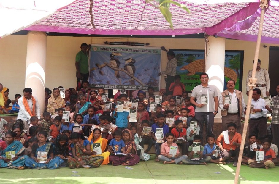
Traditional forest knowledge became scientific intelligence
Villages including:
- Ondh
- Amlor
- Aamamora
- Naripani
- Amli
- Khalgarh
- Mechka
- Bamhnijhola
- Aamgaon
- Bahigaon
- Karipani
were deeply involved in identifying historical wildlife presence.
Villagers often recalled seeing hornbills in places where they had vanished decades ago.
This guided restoration toward forgotten habitats.
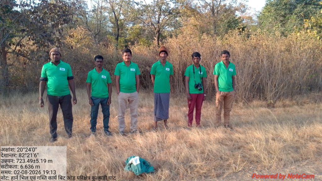
Hornbill trackers from villages built a two-year ecological database
Inspired by Elephant Mitra groups, forest officials created local hornbill trackers.
Villagers equipped with DSLR and point-and-shoot cameras documented:
- Feeding trees
- Roosting trees
- Water points
- Nesting sites
- Seasonal movement
This created a valuable long-term species-use database.
Saving cavity trees: Why dry trees are no longer treated as waste
Another major insight emerged from villagers’ habits.
Many dry cavity-bearing trees were routinely cut for firewood.
But such trees are essential nesting sites for:
- Hornbills
- Woodpeckers
- Owls
Forest teams identified these critical cavity zones and persuaded communities not to cut trees there.
Anti-poaching operations created deterrence across the border
Enforcement became equally important.
Over 60 anti-poaching operations were conducted.
This led to the arrest of nearly 500 poachers and timber smugglers, especially from Odisha-linked forest corridors.
The crackdown created a strong deterrent.
Natural regeneration faster than plantation alone
Varun Jain says plantation alone is slow.
So teams also used:
- Assisted Natural Regeneration (ANR)
- Contour trenches
- Water harvesting pits
- Soil moisture conservation
- Small wooden check dams
- Seed broadcasting
Instead of depending only on saplings, existing stumps were protected and revived.
When fenced and supplied moisture, old stumps sprouted naturally.
This accelerated forest recovery.
Wildlife returns: Four hornbill ranges, six squirrel ranges
The ecological impact is now visible.
Malabar Pied Hornbill expanded from 1 range to 4 ranges:
- Kulhadighat
- Arsikanhar
- South Udanti
- Indagaon
Giant Squirrel and Flying Squirrel now recorded in 6 of 8 ranges
This is the strongest biological evidence that habitat quality has improved.
Tigers also returned unexpectedly
Perhaps the most unexpected outcome came from tiger movement.
When the current restoration began, Udanti had no resident tiger for nearly two and a half years.
Now, three tiger sightings have been recorded within one year.
One of them has recently been confirmed as a tigress through scat analysis.
This suggests improving habitat quality at a landscape scale.
Forest recovery also reduced human-wildlife conflict
As habitat improved and hunting pressure reduced, conflict also declined.
Animals no longer moved into disturbed areas as frequently.
The restored forest gave wildlife more secure movement corridors and food availability.
A model now open for the whole state
The Google Earth Engine portal developed through this initiative is no longer limited to Udanti.
It has been designed for use across Chhattisgarh.
Any forest division can now identify:
- Forest cover loss
- Water depletion
- Encroachment hotspots
- Restoration priority zones
A forest being turned back by fifteen years
For IFS Varun Jain, the long-term goal is simple:
Restore the forest to what it looked like 15 years ago.
And for the first time, evidence suggests that the process has truly begun.
What started as encroachment removal has evolved into one of central India’s most compelling examples of AI-assisted ecological revival—where satellites, drones, local memory, and forest protection together are bringing rare wildlife back to life