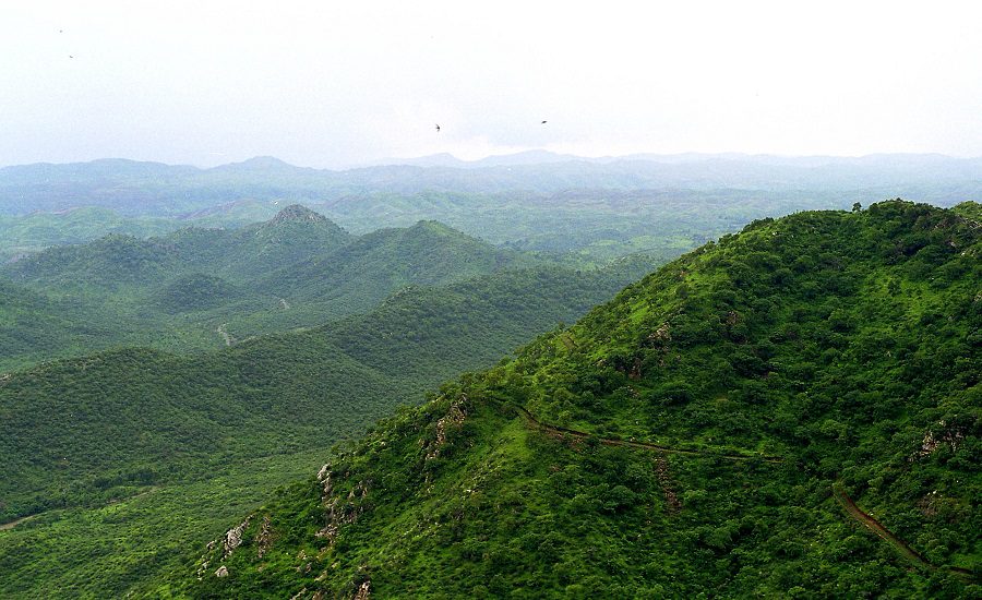
New Delhi: A recent Supreme Court decision to adopt a new definition for the Aravalli Hills—classifying only landforms 100 meters or more above the local relief as part of the range—has triggered significant environmental concerns, with internal assessments indicating the move could leave most of the Aravalli ecosystem unprotected and vulnerable to mining.
On November 20, the Supreme Court accepted the recommendations of a Union Environment Ministry panel, a step aimed at restricting illegal mining and promoting sustainable practices. Under the new criteria, only hills rising 100 meters or more above the surrounding terrain, along with adjoining slopes and land, will qualify as Aravalli.
FSI Assessment: Over 90% of the Aravallis May Lose Protection
According to an internal assessment by the Forest Survey of India (FSI), only about 1,048 hills—around 8.7% of the 12,081 hills standing 20 meters or higher in Rajasthan—meet the 100-meter height requirement. This means more than 90% of the Aravalli hills may no longer be classified as Aravalli, making them potentially open to mining and construction.
Environmental experts warn that the loss of smallear hills, especially those between 20 and 100 meters high, could have severe consequences. These lower hills serve as natural windbreaks, preventing sand and dust from the Thar Desert from drifting eastward into the Indo-Gangetic plains, including Delhi-NCR. “Lower hills are essential barriers, and their removal would significantly worsen air pollution and harm agricultural livelihoods,” an Environment Ministry official noted.
Earlier Benchmarks Suggested Much Wider Coverage
For over a decade, the FSI has used a 3-degree slope threshold to identify Aravalli hills. In 2024, a technical committee modified these criteria, proposing the inclusion of hills with:
- Slope of at least 4.57 degrees
- Height of at least 30 meters
These parameters would have covered up to 40% of the Aravalli range. However, the Ministry ultimately proposed the 100-meter benchmark to the Supreme Court.
Experts warn that the ministry’s justification combined elevation and slope data misleadingly and relied on district-wide averages that do not reflect true hill elevations. The Ministry also omitted key Aravalli districts such as Chittorgarh and Sawai Madhopur from its list.
Experts Raise Red Flags Over Exclusion Risks
Environmental lawyer Ritwick Dutta criticized the decision, stating that such parameters risk excluding vast areas that should be protected. “The Government should have erred on the side of caution. Instead, it has leaned toward exclusion, not protection,” he said.
The FSI’s September 2025 report emphasized that “even modest hills of 10–30 meters act as strong natural windbreaks,” effectively preventing near-surface sand transport over large distances.
Ministry Defends Panel Recommendations
Environment Secretary Tanmay Kumar stated that the Supreme Court had appreciated the committee’s work and supported its recommendations aimed at preventing illegal mining and promoting sustainable practices. The Court has also asked the ministry to prepare a Management Plan for Sustainable Mining in the Aravalli region in consultation with the Indian Council of Forestry Research and Education (ICFRE).
FSI’s new Director General Santosh Tiwari noted he had recently taken charge and would examine the matter further.
Background: How the Definition Evolved
- 2010: FSI proposed a 3-degree slope threshold and district-specific minimum elevations.
- 2024: Technical sub-committee suggested a height of 30m and slope of 4.57 degrees.
- 2025: FSI submitted detailed hill maps showing the importance of even small hills.
- October 2025: Ministry told the SC that Aravalli states had agreed to the 100-meter criterion.
With the Supreme Court now endorsing the 100-meter benchmark, environmentalists say the future of India’s oldest mountain range—and the ecological protection it provides—may be at stake.