When IFS officer Nitish Kumar joined Jharkhand’s forests in 2019 as a young DFO from the 2017 batch, he stepped into one of India’s toughest conservation challenges: managing human-elephant conflict. Herds often wandered into farms and villages, leaving behind destroyed crops, damaged houses, and sometimes even human casualties.
At that time, the reporting system was simple yet chaotic. Information about elephant herds was shared in WhatsApp groups through GPS coordinates.
“The GPS data on WhatsApp was not user-friendly. You had to sit at a laptop, enter the numbers manually, and then try to figure out where the herd actually was. For someone who knew every village, it was manageable. But for a nearby division, it was confusing and slow,” he shared in an exclusive conversation with Indian Masterminds.
For Kumar, this wasn’t just a technical glitch; it was a life-threatening gap in communication. If a herd crossed into a boundary area, officials often lost precious time locating it and mobilizing resources. That delay could mean the difference between safety and damage.
A VISION FOR REAL-TIME MAPPING
It was then that Kumar began asking a simple but game-changing question: What if elephant movements could be seen directly on a map?
“Suppose I’m in Ramgarh and a herd is near the Ramgarh–Bokaro boundary,” he explains. “On WhatsApp, it’s just a string of numbers. But if I see it on a map, I immediately know it’s close to my division. I can shift my resources instantly.”
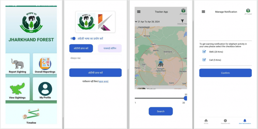
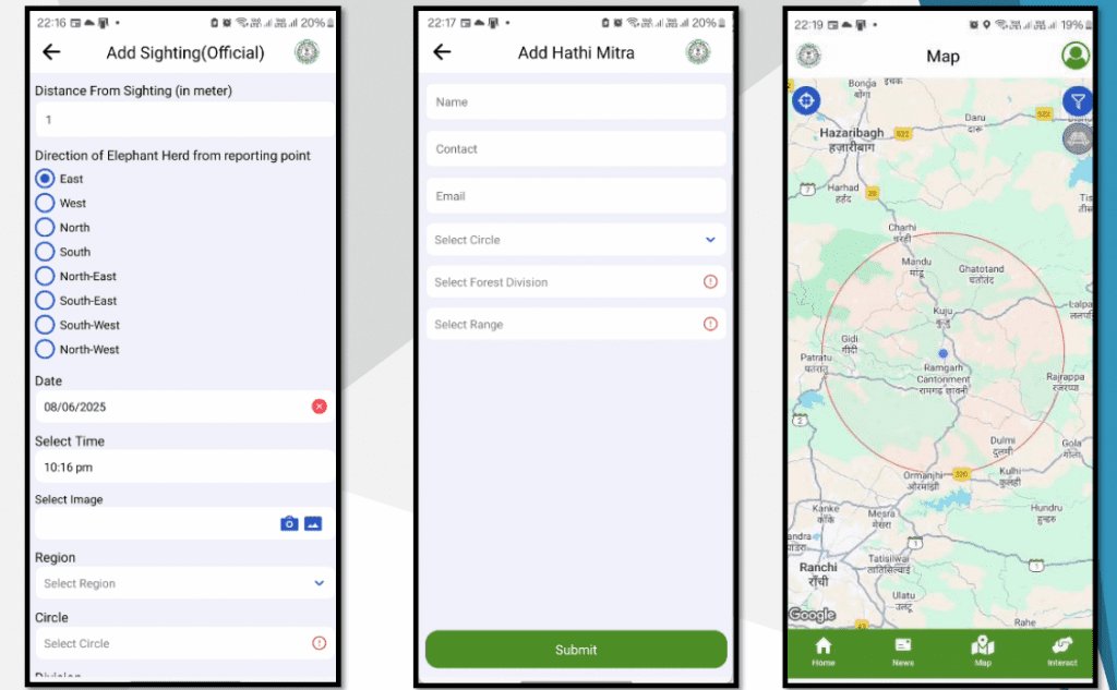
That thought led to the creation of Hamar Hathi, a mobile application designed to make elephant tracking visual, accessible, and instant.
FROM HAMAR HATHI 1 TO HAMAR HATHI 2.0
The first version, Hamar Hathi 1, rolled out for internal use, allowed field staff to report herd sightings that were displayed directly on a digital map. For the first time, forest divisions could see elephant movements across boundaries and plan coordinated responses.
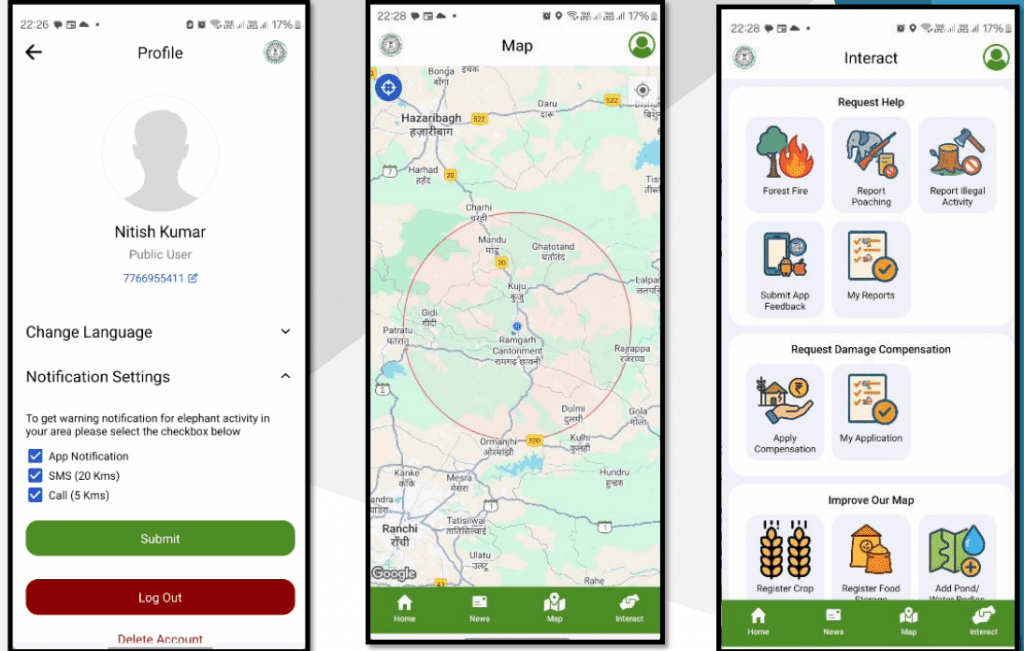
Over time, feedback and field challenges led to a more advanced Hamar Hathi 2.0. This version combined internal reporting with public participation, giving villagers a way to both see elephant presence within a 20 km radius and register for SMS alerts and IVRS warning calls.
In its very first year, the app broadcast over 1 lakh SMS alerts and more than 30,000 warning calls, providing villagers with crucial minutes to protect themselves and their crops.
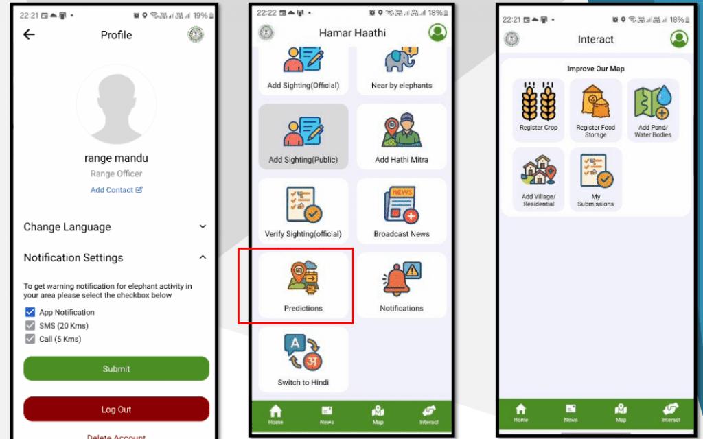
EMPOWERING VILLAGERS AS HATHI MITRAS
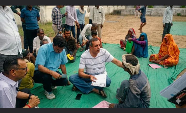
A unique feature of the app was the inclusion of trained community members called Hathi Mitras (Elephant Friends). These villagers, trusted by the department, could feed data directly into the system without validation.
“There are two options,” says Kumar. “If a villager reports, it goes for validation. But if a Hathi Mitra reports, it is trusted and goes straight to the map. This makes our response faster and more reliable.”
This approach not only improved accuracy but also built a bridge of trust between the forest department and rural communities, who face the brunt of elephant movements.
THE AI LEAP IN PREDICTION
While Hamar Hathi 2.0 has already transformed conflict management, Kumar and his team are taking it a step further with an AI prediction module. By analyzing movement data collected over time, the system will soon predict the probable direction of a herd’s journey, giving officials a 70% to 90% confidence forecast.
“Elephants move based on memory. If we collect enough digital data, AI can help us anticipate their path. That means instead of spreading our staff everywhere, we can focus on just two or three critical locations. It will reduce casualties and property loss significantly,” he shared with Indian Masterminds.
MORE THAN TRACKING
The app is also evolving into a comprehensive platform for forest–community interaction. New features include the ability to submit compensation claims for crop or property damage and even report waterbodies, which helps the department plan better for elephant needs.
This multi-layered system, including internal reporting, public reporting, AI predictions, alerts, and community integration, marks a shift from reactive to proactive conflict management.
THE BIGGER PICTURE
For Jharkhand, a state where elephant corridors overlap with densely populated areas, Hamar Hathi is proving to be more than just a digital tool. It is helping save crops, reduce conflict, and most importantly, protect lives on both sides, human and elephant.
Kumar remains grounded about the journey ahead. “It will take another year for the AI module to fully develop and for the app to reach every corner,” he says. “But we are already seeing the difference. The more data we collect, the smarter the system becomes. Ultimately, it’s about ensuring the safety of people and of elephants.”
A SMARTER COEXISTENCE
From clunky WhatsApp coordinates to AI-enabled predictions, the journey of Hamar Hathi is a story of innovation born out of necessity. It reflects the possibilities that emerge when technology, community, and conservation work together.
In the dense forests and fragile farmlands of Jharkhand, elephants continue to roam as they always have. But now, thanks to a young officer’s vision, their movements are being tracked, mapped, and anticipated, making coexistence a little less dangerous and a lot more hopeful.