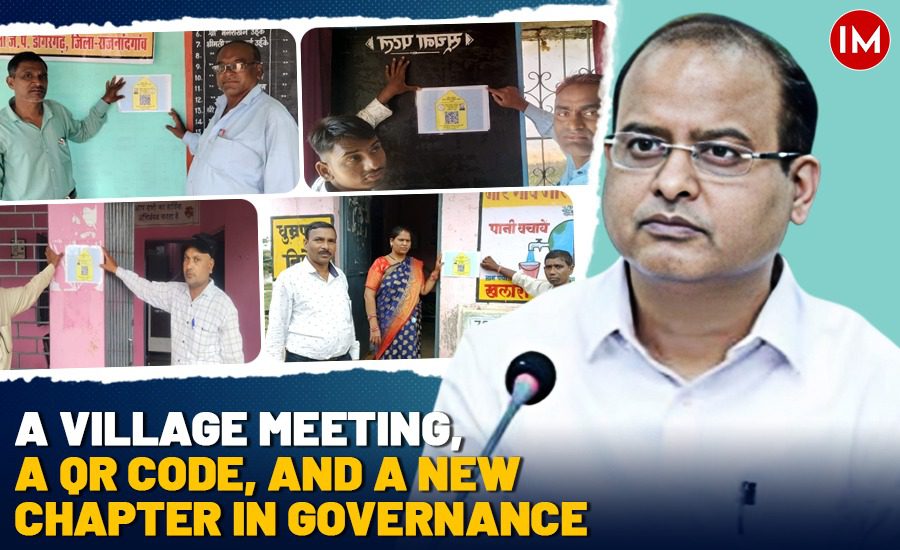
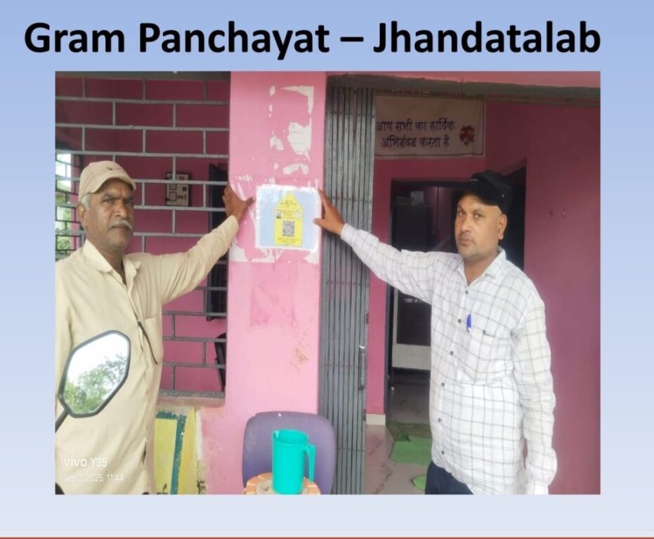
It was an ordinary Gram Panchayat meeting in a small village of Chhattisgarh. Men and women gathered under the shade of a tree, as they often do. But this time, something unusual happened. A laminated QR code hung beside the Panchayat office caught everyone’s eye. Out of curiosity, a few villagers scanned it using their smartphones – and instantly, details of local MGNREGA (Mahatma Gandhi National Rural Employment Guarantee Act) projects, complete with budget and status, appeared on their screens.
For a scheme that had long struggled with opaque systems and limited village-level access to real-time data, this was nothing short of revolutionary.
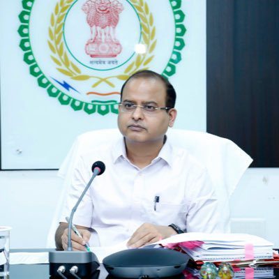
“People were genuinely surprised. They didn’t expect this level of information to be just a scan away,” said Taran Prakash Sinha (2012 batch IAS), Commissioner, MGNREGA, Chhattisgarh to Indian Masterminds. “It was a small moment, but it showed us the power of simple technology in building public trust.”
THE SPARK BEHIND THE IDEA
The idea didn’t come from a boardroom but from the field. During a visit to rural areas with Principal Secretary Ms Niharika Barik Singh, it became evident that QR codes were already a familiar tool in villages – used widely for digital payments and small business transactions.
Villagers trusted QR codes. They found them easy and convenient. This insight, combined with the administration’s ongoing push for good governance and transparency, led to a breakthrough idea: why not use QR codes to open up access to MGNREGA data?
Ms Singh, who also heads both the Panchayat and Rural Development and IT Departments, gave the green light for a pilot project. It’s now being rolled out across the state.
HOW IT WORKS
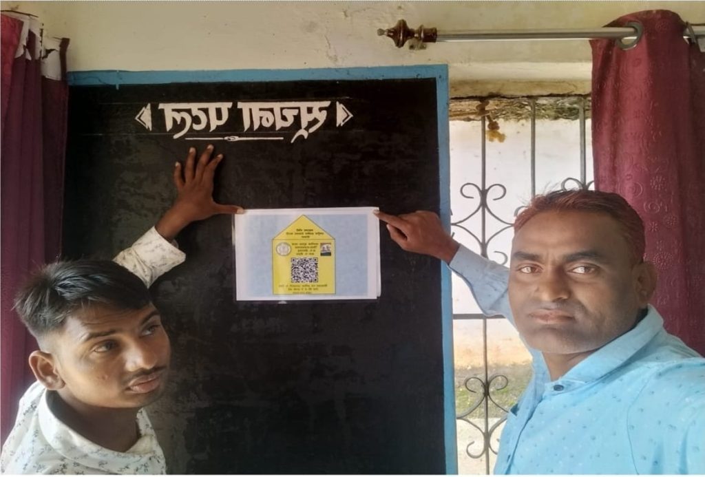
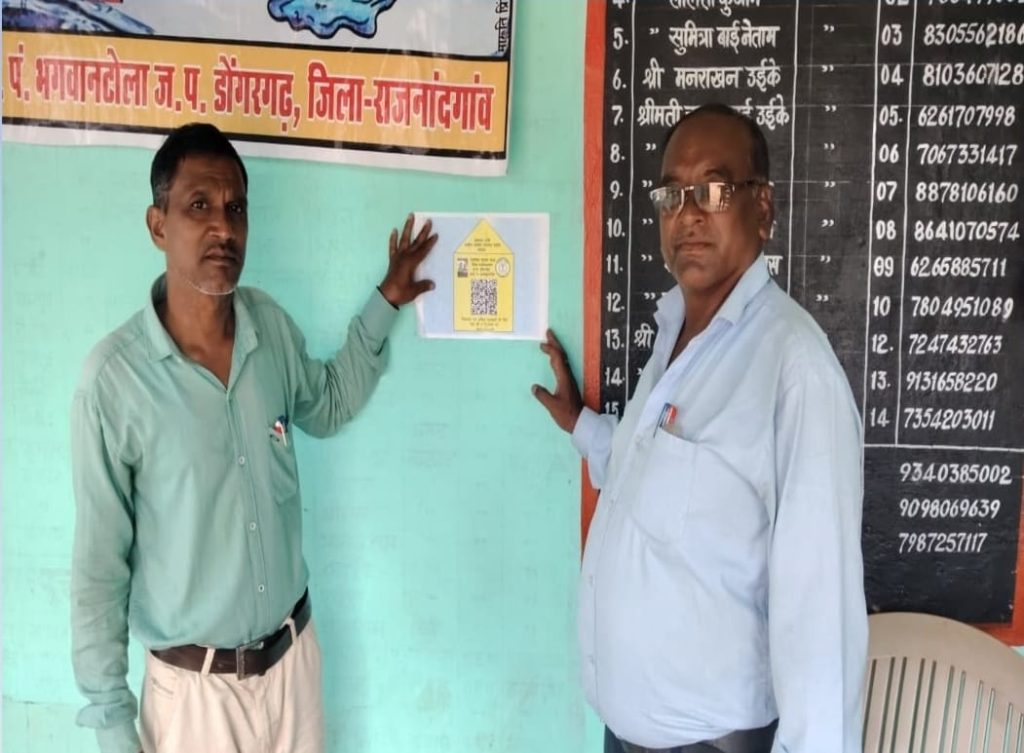
QR codes are now being generated for every Gram Panchayat. These codes are displayed on Panchayat walls and other prominent locations in villages. Any villager with a basic smartphone can scan the code and access information such as:
- List of MGNREGA projects carried out in the past three years
- Funds sanctioned and spent
- Progress of ongoing works
This data, earlier accessible only through district offices or official websites (often in English or technical formats), is now literally at the fingertips of rural citizens.
“Now people don’t need to ask or guess—they can verify. This is how transparency becomes real,” said Mr Sinha.
MAPPING THE FUTURE
In addition to QR codes, the government is also introducing GIS-based planning for MGNREGA using the Yuktidhara portal launched by the Government of India.
This system uses satellite maps to plan rural works more scientifically – taking into account geography, water bodies, soil type, and existing infrastructure. With the help of this data, Gram Panchayats can now prepare more efficient and need-based labour budgets.
Training sessions are ongoing to help staff use this system. Once the labour budgets are finalized, they will be painted on Panchayat walls so that every resident knows which works have been approved for the coming year.
CHALLENGES ON THE GROUND
Of course, innovation rarely comes without hurdles. The team faced several issues in implementing this tech-driven system in rural areas:
- Patchy internet connectivity in remote villages
- Limited digital skills among local staff
- Data inconsistency, as past records were not uniformly digitized
But the government responded swiftly:
- Low-data QR formats were developed to work even in areas with weak signals
- Training workshops were conducted for field staff and Panchayat functionaries
- IT teams coordinated with local departments to ensure backend data integration
Still, there are future challenges to address—like keeping data regularly updated, maintaining community engagement, and ensuring that new staff and volunteers continue to receive digital training.
REACHING THE UNREACHED
One of the most thoughtful aspects of this initiative is its inclusive approach. The government recognizes that not everyone in rural areas owns or knows how to use a smartphone – particularly older residents and women in remote villages. To ensure these groups are not left out, several supportive measures have been put in place. Demonstrations and awareness drives are regularly conducted during Gram Panchayat meetings to familiarize villagers with the new system.
Self-Help Groups (SHGs) and Gram Rojgar Sahayaks are playing an active role in guiding people on how to scan the QR codes and access information. For those without digital access, key details such as labour budgets and sanctioned works are also being displayed physically on Panchayat walls, in simple and easy-to-read formats. By blending technology with traditional methods of communication, the initiative ensures that transparency reaches everyone – regardless of their digital literacy.
EARLY SIGNS OF CHANGE
The early feedback from pilot villages has been promising. In some places, the introduction of QR codes has sparked a new kind of curiosity among villagers.
Panchayat members say that villagers now suggest future projects more actively, knowing they can track the outcomes later. The presence of data has given people confidence – and made local governance feel more responsive and participatory.
A MODEL FOR INDIA?
Though still in its early stages, the QR code and GIS-based initiative has the potential to be a game-changer not just for Chhattisgarh, but for the entire country.
“Any scheme where people need to track spending or progress can use this model,” said Mr Sinha. “It’s affordable, scalable, and more importantly – it works.”
As India continues its push for digital governance, the Chhattisgarh model could well become a national template. With the right mix of technology, training, and community participation, even the most remote village can now hold its leaders accountable – one scan at a time.