New Delhi: The Udanti-Sitanadi Tiger Reserve (USTR) in Chhattisgarh has reclaimed approximately 106 hectares of encroached forest land in its Sitanadi Core Range, marking a major enforcement and habitat-restoration operation backed by satellite imagery, DGPS-enabled drone mapping and coordinated deployment of forest, police and district administration personnel.
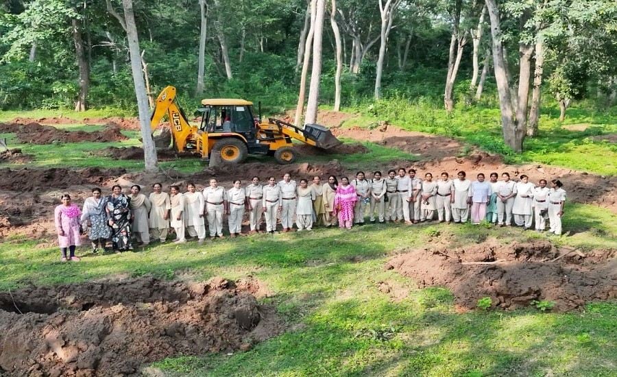
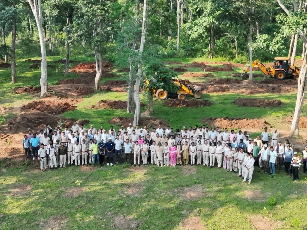
The operation, carried out on September 16, 2026, was led by women forest personnel from Dhamtari, Gariaband, Kanker and Udanti-Sitanadi Tiger Reserve. As many as 50 women forest personnel participated in the operation, supported by approximately 200 male forest staff and 51 police personnel.
Despite the sensitive nature of the exercise and the presence of a large number of people associated with the encroachment, the operation remained completely peaceful and orderly, with no untoward incident reported.
Women Forest Teams Lead Major Reclamation Operation
The September 16 operation represented a coordinated effort involving USTR, the police and the district administration to reclaim forest land that had been under encroachment for several years.
The women-led forest teams played a frontline role in carrying out the field operation and coordinating with other personnel deployed at the site. The deployment included forest staff from multiple districts and units, along with police personnel to support enforcement and maintain law and order.
Approximately 200 male forest personnel and 51 police personnel supported the 50 women forest personnel deployed from Dhamtari, Gariaband, Kanker and USTR.
The coordinated deployment enabled the authorities to undertake the reclamation while maintaining a controlled and peaceful environment.
Read also: IFS 2025 Probationers Begin Hands-On Ecology, Conservation Training at IGNFA with NCBS
Technology Used to Monitor the Operation
USTR adopted a technology-enabled surveillance strategy to ensure that the operation could be monitored continuously and that any attempt to obstruct the government action could be documented.
Three dedicated drone squads were deployed during the operation. The drones monitored movement in and around the operation area and allowed field teams to maintain situational awareness from a safe distance.
Before the operation, the accused persons and others present in the area had been warned that any attempt to obstruct the government operation would be recorded through high-tech drone surveillance. They were informed that persons involved in any such obstruction could subsequently be identified and dealt with in accordance with law.
They were also informed that any violation of the conditions attached to anticipatory bail could be brought before the competent court for appropriate legal action.
The aerial surveillance therefore served not only as a monitoring mechanism but also as a means of scientifically documenting any attempt to interfere with the reclamation process or reoccupy the forest land.
The combination of advance warning, substantial ground deployment and continuous drone-based surveillance contributed to the operation remaining peaceful.
Encroachment Expanded from 45 Hectares to 106 Hectares
The encroachment in the Sitanadi Core Range has a history going back to 2011–13.
According to the recorded Preliminary Offence Report (POR), the encroached area was approximately 45 hectares at that time. Over the subsequent years, the encroachment progressively expanded, reaching approximately 106 hectares.
The expansion resulted in degradation and fragmentation of an important core wildlife habitat.
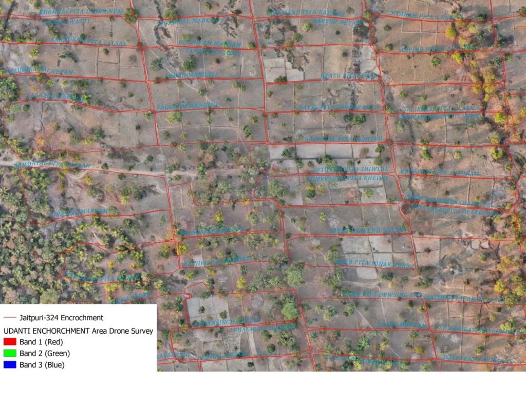
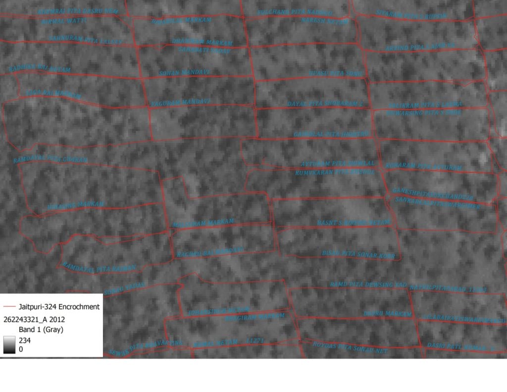
To establish the extent and temporal progression of the encroachment scientifically, USTR used ISRO satellite imagery along with DGPS-enabled drone mapping.
Satellite imagery from different periods was analysed to understand changes in land use and establish how the encroached area had expanded over time. This was supplemented by DGPS-enabled drone surveys that provided precise ground-level mapping and measurement.
The combination of historical satellite imagery and high-precision drone mapping enabled the department to scientifically establish the present extent and boundaries of the encroached area. The information also provided an evidentiary basis for enforcement and subsequent restoration planning.
More Than 1,000 Hectares Reclaimed in Four Years
The recovery of 106 hectares from the Sitanadi Core Range is part of a broader anti-encroachment campaign being undertaken by USTR.
During the past four years, the Tiger Reserve has removed encroachments from more than 1,000 hectares of forest land across different areas.
The campaign has been structured around identification and mapping of encroachments, enforcement and legal action, protection of reclaimed areas and ecological restoration.
The department’s objective is not limited to removing people or structures from encroached land. Reclaimed areas are to be secured and restored so that they can be returned permanently to forest and wildlife management.
This approach is particularly important in core and critical wildlife habitats, where fragmentation or conversion of forest land can affect ecological processes and wildlife movement.
166 Accused Identified, 40 Arrested
The reclamation operation has been preceded by legal proceedings and enforcement action against persons allegedly connected with the encroachment.
A total of 166 accused persons have been identified in connection with the case, while 40 have been arrested so far.
The anticipatory bail applications filed by the accused were initially rejected by the Dhamtari Upper Sessions Court. The accused subsequently approached the High Court, which granted anticipatory bail subject to conditions.
Among the conditions was a requirement for the 166 accused to cooperate with the investigation and not repeat the offence.
USTR has continued its investigation and field verification to establish the individual roles of those allegedly involved and to monitor compliance with the conditions imposed by the High Court.
Fresh Attempt to Reoccupy Land Reported on August 18
The legal proceedings were followed by another incident on August 18, 2026, when approximately 50–70 persons allegedly attempted to again occupy or reclaim the forest land.
USTR has treated the incident as an alleged attempt to repeat conduct that is already the subject of investigation.
The department is undertaking detailed identification and verification of the persons actually involved in the August 18 incident. The process includes field investigation, examination of available records and the use of technological evidence, including drone surveillance wherever applicable.
Once the individuals actually responsible are identified and the alleged violation is established, USTR will take appropriate legal steps before the competent court.
This may include seeking appropriate action concerning alleged non-compliance with the conditions attached to anticipatory bail, in accordance with law.
Restoration Begins After Reclamation
For USTR, removing encroachment is only the first stage of recovering the degraded habitat.
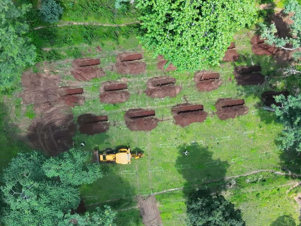
Following reclamation, ecological restoration measures have been initiated in the area to rebuild forest functions and improve the landscape’s ability to retain water and support wildlife.
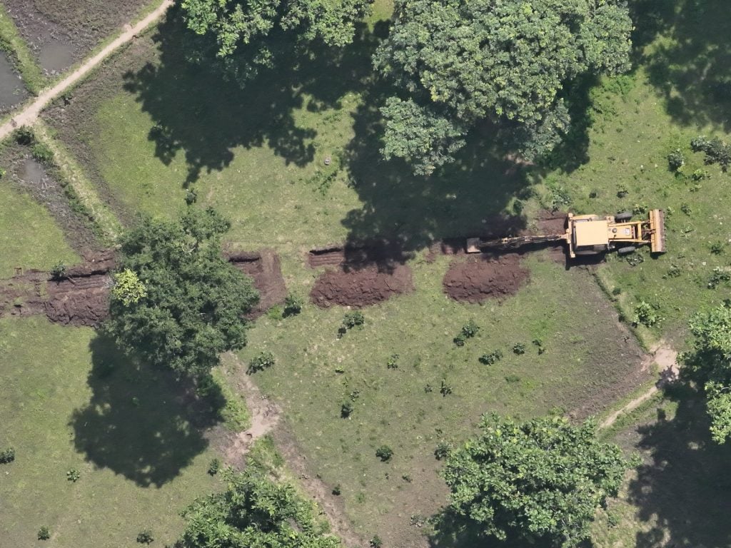
The restoration programme includes contour trenches designed for rainwater harvesting and soil-moisture conservation. These measures are also intended to improve water retention and groundwater recharge in the Mahanadi Basin.
Approximately 1,500 saplings are also being planted as part of the restoration effort.
Alongside plantation, the department is working towards restoring natural vegetation and wildlife habitat so that the reclaimed area can progressively return to a functional forest ecosystem.
The restoration strategy therefore combines soil and water conservation with vegetation recovery and habitat improvement rather than treating the reclamation simply as an enforcement exercise.
Reclaimed Land Forms Part of an Elephant Movement Corridor
The ecological significance of the reclaimed landscape extends beyond the 106 hectares itself.
The area forms part of an elephant movement corridor and is situated close to the origin area of the Mahanadi River. The location therefore has importance for both wildlife movement and the wider ecological functioning of the landscape.
Habitat destruction and fragmentation can disrupt wildlife movement and reduce the availability of natural resources. In landscapes supporting elephants and other wildlife, such changes can also contribute to conditions that increase the possibility of human-wildlife conflict.
Restoring contiguous forest cover and improving water availability can strengthen habitat connectivity and support wildlife movement.
For USTR, protection of the area therefore involves both preventing further encroachment and restoring habitat that has already been degraded through human intervention.
Community Cooperation Supports Protection
The reclamation operation also received cooperation from villagers of Ghurawad, Barbandha and Bhursidongri.
The participation and cooperation of local communities can be important for protecting reclaimed forest land over the long term. Once an encroached area has been recovered, continued vigilance is necessary to prevent renewed occupation and ensure that restoration efforts are not undermined.
Community cooperation, combined with enforcement and technological monitoring, can therefore support the department’s efforts to secure the reclaimed landscape.
Women at the Frontline of Forest Protection
One of the defining features of the September 16 operation was the prominent role played by women forest personnel.
Fifty women forest personnel from Dhamtari, Gariaband, Kanker and USTR participated in the field operation and led the reclamation effort, supported by around 200 male forest staff and 51 police personnel.
Their participation highlights the expanding role of women in frontline forest protection, wildlife enforcement and field-level conservation operations.
The operation also demonstrated how women forest personnel can be deployed in coordinated enforcement operations involving sensitive forest and wildlife habitats, with support from police and other forest staff.
Enforcement Followed by Long-Term Protection
The reclamation of approximately 106 hectares in the Sitanadi Core Range is part of USTR’s continuing effort to secure its core and critical wildlife habitats.
The operation brought together scientific evidence, technological surveillance, legal enforcement, inter-agency coordination, community cooperation and ecological restoration.
The use of ISRO satellite imagery and DGPS-enabled drone mapping helped establish the scale and progression of the encroachment, while drone squads provided real-time surveillance during the field operation. Legal proceedings and arrests have accompanied the enforcement process, while restoration activities have begun on the reclaimed land.
With more than 1,000 hectares of forest land reclaimed from encroachment over the past four years, USTR is continuing its efforts to prevent renewed occupation and ensure that recovered forest areas remain available for wildlife and ecological processes.
The September 16 operation thus represents both an enforcement action and the beginning of a longer process of habitat recovery, protection and restoration in one of USTR’s critical forest landscapes.
Read also: Palamau Tiger Reserve Launches AI Lab to Equip Rural Youth With Digital and Entrepreneurial Skills