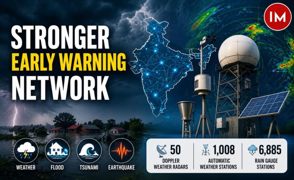
New Delhi: India is strengthening its multi-hazard early warning network under Mission Mausam, with expanded weather, flood, tsunami and earthquake monitoring systems aimed at improving real-time forecasting and disaster preparedness. The government said severe-weather forecast accuracy has improved by 40–50% over the past decade, while the country now has 50 Doppler Weather Radars, 1,008 Automatic Weather Stations and 6,885 rain gauge stations nationwide.
Weather Observation Network Expanded
India has significantly strengthened its weather observation network under Mission Mausam, with the India Meteorological Department (IMD) operating:
- 50 Doppler Weather Radars
- 1,008 Automatic Weather Stations
- 6,885 rain gauge stations
The expanded network has contributed to a 40–50% improvement in severe-weather forecast accuracy over the past decade, while reducing errors in cyclone track, landfall and intensity forecasts.
Flood and Tsunami Warning Systems
For flood monitoring, 25 Flood Meteorological Offices issue seven-day precipitation forecasts for 220 sub-basins, supporting the Central Water Commission and integrated flood-warning systems in Chennai and Mumbai.
INCOIS, the designated Tsunami Service Provider for 28 Indian Ocean Rim countries, uses real-time ocean data and platforms such as Sachet and SAMUDRA for alerts.
Twenty-six coastal villages in Odisha have received UNESCO-IOC Tsunami Ready recognition.
Digital Platform for Multi-Hazard Warnings
The Multi-Hazard Early Warning–Decision Support System (MHEW-DSS), developed by IMD under the Ministry of Earth Sciences, provides a digital platform for real-time weather monitoring and early warnings.
Developed using open-source technology and in-house expertise, the system is intended to deliver timely and actionable weather information across sectors and regions.
Himalayan and Coastal Hazard Monitoring
Government agencies are also conducting research on climate-related hazards in the Himalayas and coastal regions.
Key activities include:
- NCESS: Flood and hydrological modelling for hazard studies in the Garhwal Himalaya.
- NCPOR: Long-term monitoring of eight benchmark glaciers in Himachal Pradesh and Arunachal Pradesh.
- INCOIS: Research under the Deep Ocean Mission projects 0.62–0.87 metre mean sea-level rise along India’s coastline by 2100 under a high-emission scenario.
- NIOT: Ocean monitoring through moored buoys, coastal HF radars and tsunami buoys.
These efforts are supported by MoES policy publications and IMD’s GIS-based Climate Hazards and Vulnerability Atlas of India.
Glacier Monitoring in the Himalayas
The Indian Institute of Tropical Meteorology (IITM), Pune, is conducting atmospheric and cryospheric observations across the Gangotri–Gaumukh and Satopanth Glacier regions under its Metropolitan Air Quality and Weather Forecasting Services project.
The programme includes mobile observations along the Gangotri–Gaumukh–Tapovan route and a continuous monitoring station at Bhojbasa, around 3,500 metres above mean sea level.
Earthquake Monitoring Network Doubled
The National Center for Seismology has expanded India’s National Seismological Network from 86 observatories in 2014 to 174 active observatories.
Of these, 89 observatories are located in high-risk Seismic Zones IV and V.
The expanded network has lowered the nationwide earthquake detection threshold to Magnitude 3.0, while Delhi-NCR and the northeastern regions have achieved a threshold of Magnitude 2.5.
₹270 Crore Allocation for Polar and Cryosphere Research
For 2026–27, the proposed allocation for the National Centre for Polar and Ocean Research under the Polar Science and Cryosphere Research (PACER) scheme is ₹270 crore.
Read Also: IMD Boosts Northeast India Flood Preparedness with BharatFS and Multi-Hazard Warning System