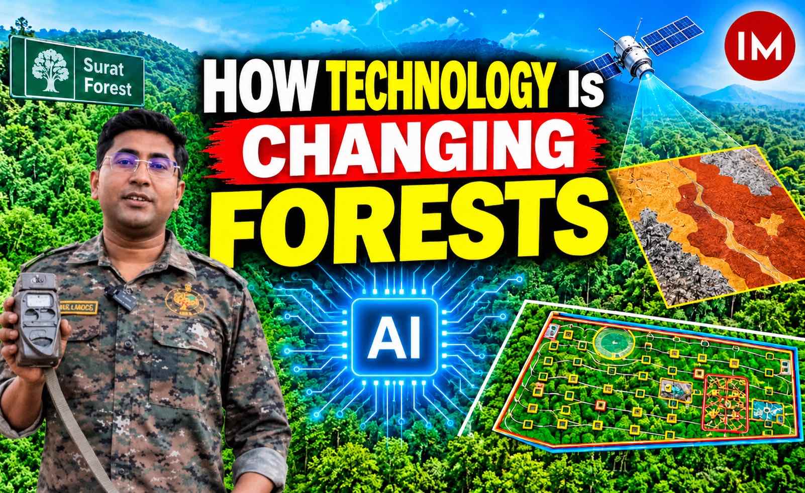
Managing forests is no longer just about protecting trees, monitoring wildlife and carrying out plantation drives. It also requires accurate data, scientific planning, timely monitoring and efficient use of resources. As technology transforms almost every sphere of governance, the Gujarat Forest Department’s Surat Forest Division is demonstrating how even smartphones and accessible digital tools can make forest management more efficient, transparent and accountable.
From digitally mapping forest landscapes and plantation sites to preparing AI-assisted treatment maps, recording forest offences through GPS-based photographs and training frontline personnel in modern technology, the Division is gradually moving away from conventional paperwork towards data-driven forest governance.
Behind these efforts is a simple objective: make forest management more scientific, reduce the burden of repetitive manual work and empower field personnel with tools that help them perform their responsibilities more effectively.
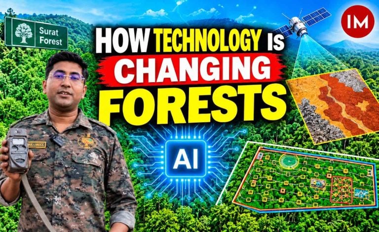
To understand how these initiatives are being implemented, Indian Masterminds interacted with Gaurav Lodha, an Indian Forest Service (IFS) officer of the 2023 batch from the Gujarat Cadre, currently serving as Assistant Conservator of Forests (ACF), Surat Forest Division. Explaining the idea behind the initiative, he said that the Division wanted to integrate technology into routine forestry operations to improve both the quality of planning and the efficiency of its staff.
How It Started: Taking Forest Management Beyond Paperwork
One of the major areas where the Division identified an opportunity for technological intervention was plantation planning.
Traditionally, every forest division prepares treatment maps a year before plantation activities begin. These documents contain detailed information about the proposed work in a particular plot, including the number of plantation pits, tree species, spacing, contour trenches, soil and water conservation structures and other protection measures.
Also Read: From a Balcony in Gangtok, an IAS Officer Harvests Honey and Promotes Harmony with Nature
The plans are subsequently sent to the headquarters for approval and become the basis for the following year’s plantation targets.
However, preparing these maps involved considerable manual effort. Field personnel had to visit sites, measure areas, prepare maps and manually enter information about the proposed activities.
Gaurav Lodha explained that the Division decided to digitise this entire process during the current year.
“Whenever plantation work is planned, a treatment map is prepared one year in advance. It is essentially a document containing all the details of the activities proposed in a particular plot. Earlier, most of this work was done manually. Staff had to visit the field, prepare maps and enter the details repeatedly. We decided to digitise the process to improve efficiency and reduce the workload of our personnel,” he explained.
The initiative was not limited to replacing paper records with digital documents. The objective was to make planning more accurate, visually understandable and technically sound.
Training the Frontline Staff: The First Step
Introducing technology into forest administration requires more than providing smartphones or software. The people responsible for implementing the work must understand how to use these tools.
Recognising this, the Division began by training its frontline personnel, including Range Forest Officers, foresters and beat guards.
The training programme, conducted over approximately four to five months at different intervals, included both classroom and field sessions.
Personnel were introduced to GPS, Geographic Information Systems (GIS), Artificial Intelligence, Google Earth navigation and the preparation of KML and KMZ files. They were also taught how to store relevant information in digital maps and use AI tools to organise information and generate three-dimensional visualisations.
Lodha said that the first challenge was to familiarise field personnel with technology, as many of them had limited prior exposure to these applications.
“We first had to explain what AI is, how it works and how it can be used in our daily activities. We organised classroom as well as field training sessions so that personnel could understand the tools practically. Once they became familiar with the technology, we explained how it could help them prepare better treatment maps with much less manual effort,” he said.
So far, 113 forest personnel have been trained, with the long-term objective of enabling staff at the beat level to independently use smartphones for mapping, navigation and digital reporting.
AI-Assisted Treatment Maps: Making Plantation Planning Scientific
One of the most significant applications of technology in the Division is the preparation of AI-assisted treatment maps.
The Division has mapped approximately 2,500 hectares of forest land using KML files and prepared AI-assisted treatment plans for 1,100 hectares spread across 25 plantation plots.
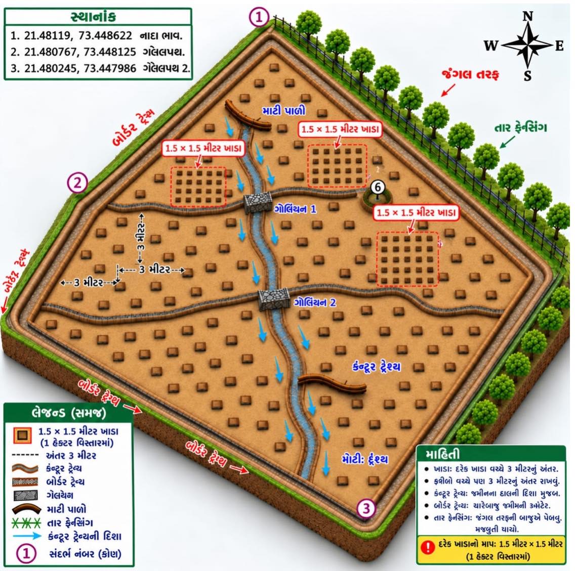
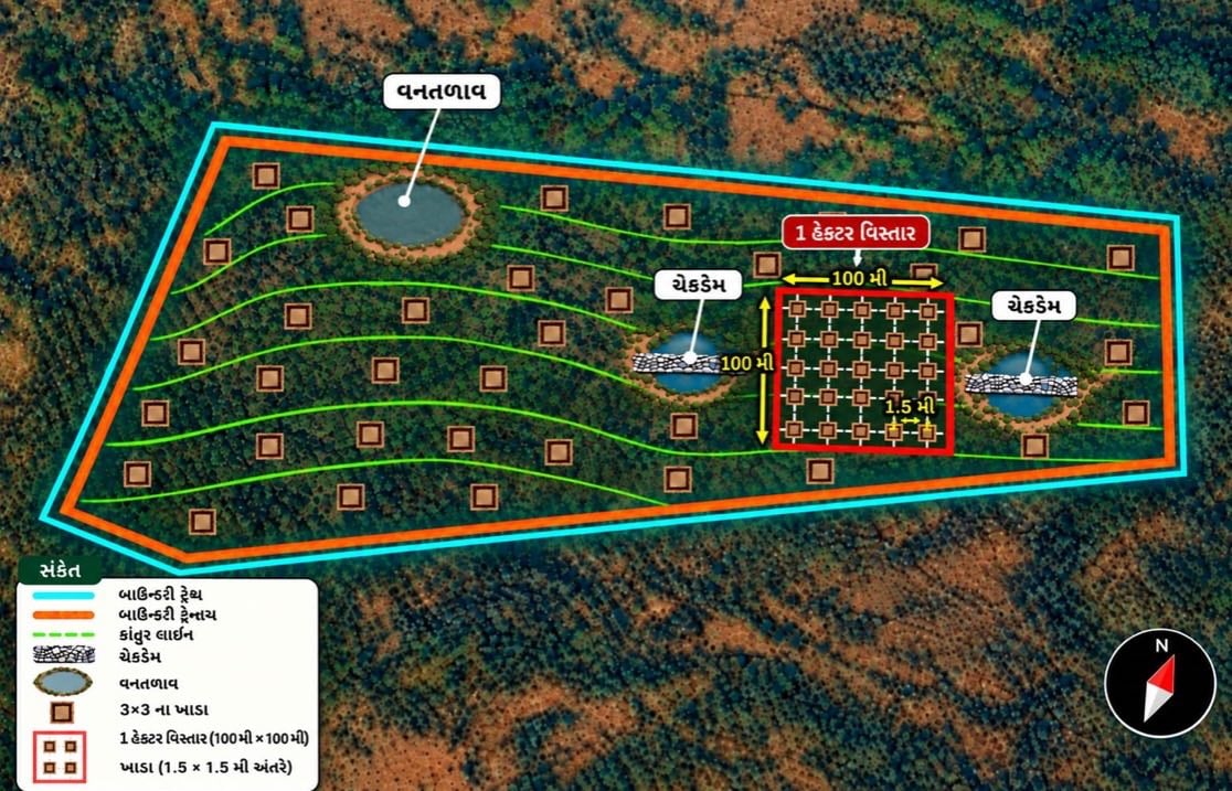
These maps combine field-survey information, geographical boundaries, terrain details, slopes, drainage patterns and soil characteristics to create comprehensive plans for individual plantation sites.
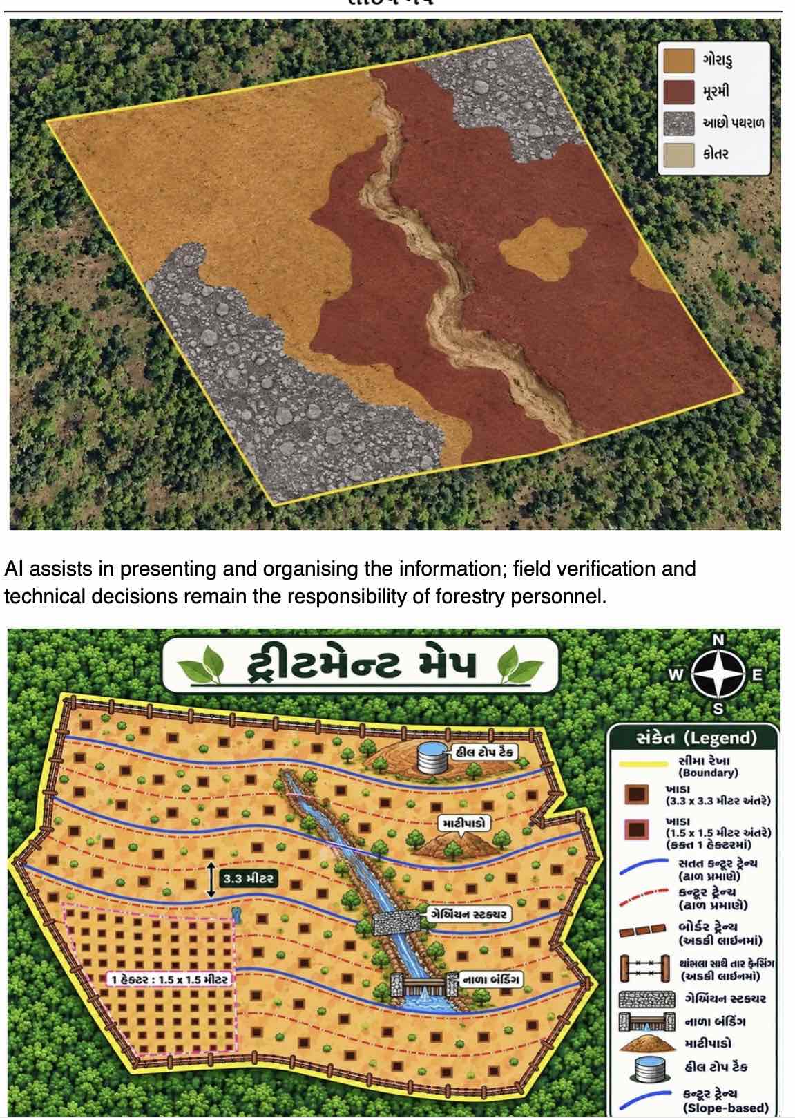
AI helps organise the information and convert it into colour-coded layouts that clearly indicate the proposed interventions.
For instance, if a particular plot requires plantation of 1,000 trees, the earlier process involved manually calculating and entering the number of trees of different species. The new system helps automate such calculations.
Lodha explained, “Suppose we have a 10-hectare plot where we need to undertake plantation. Once we enter the dimensions and other details, AI helps generate a table showing the area, location and the number and types of species that can be planted. We have automated several repetitive calculations that earlier had to be done manually.”
The maps also incorporate photographs and visual representations of the terrain. This helps personnel understand the location, dimensions, water-flow direction and physical characteristics of a plantation site even before visiting it.
The planning follows a ridge-to-valley approach, ensuring that conservation interventions are designed according to the natural landscape.
Depending on site conditions, treatment plans may include plantation pits at three-metre spacing, high-density plantation blocks at 1.5-metre spacing, contour trenches, boundary fencing, gabions, nala bunding, hilltop tanks and forest ponds.
The Division also prepares digital soil maps distinguishing goradu soil, murrum and stony patches. This information helps determine suitable plantation species and conservation measures for different locations.
Importantly, AI assists in organising and presenting information, while field verification and technical decisions remain the responsibility of forestry personnel.
Google Earth and KML Files: Mapping Every Important Location
Another important component of the initiative is the use of Google Earth and KML/KMZ files to create digital records of forest landscapes.
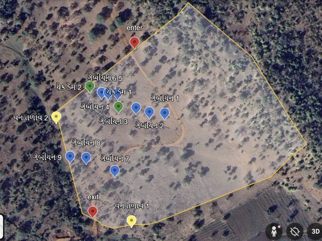
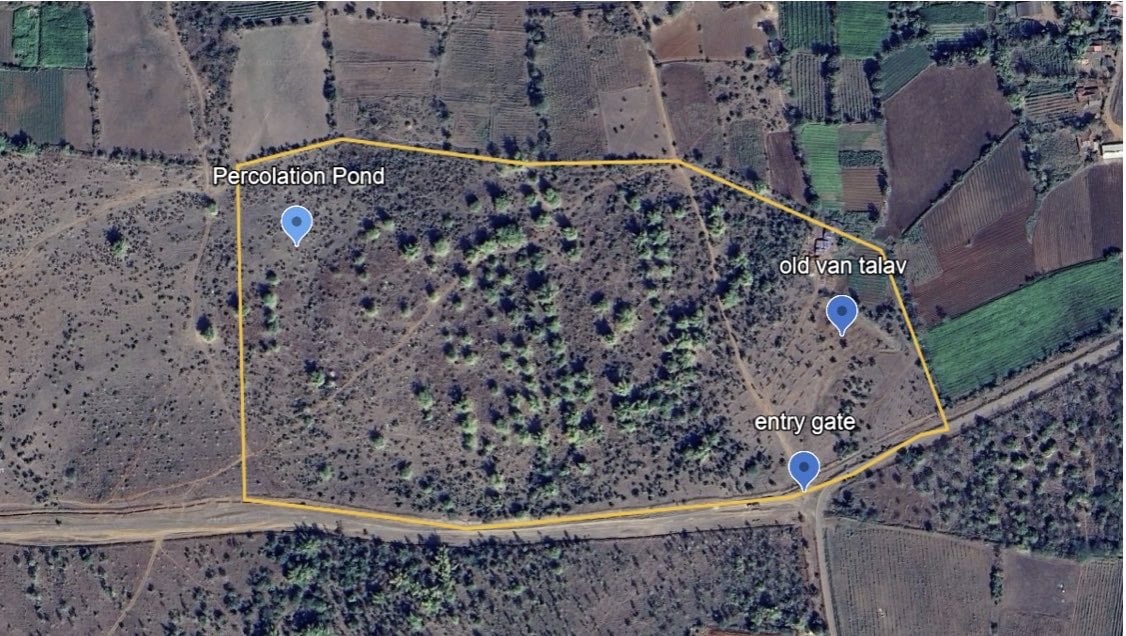
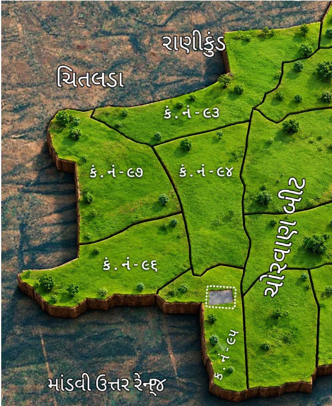
Plantation boundaries, forest compartments, beats and soil and water conservation structures are being mapped digitally. Boundaries are marked through polygons, while individual structures such as check dams, gabions and forest ponds are recorded using specific map markers.
Entry and exit points are also mapped wherever required.
These digital maps can be accessed through smartphones, allowing field personnel to navigate directly to specific locations without depending entirely on conventional directions or repeated field measurements.
Google Earth’s measurement and elevation tools further help officers assess the area, perimeter and elevation profile of a site during preliminary planning.
The technology is also being used to identify and map encroached land, plantation areas and forest-fire-affected locations.
GPS-Based Monitoring: Every Photograph Has a Location
Technology is also strengthening forest protection and monitoring.
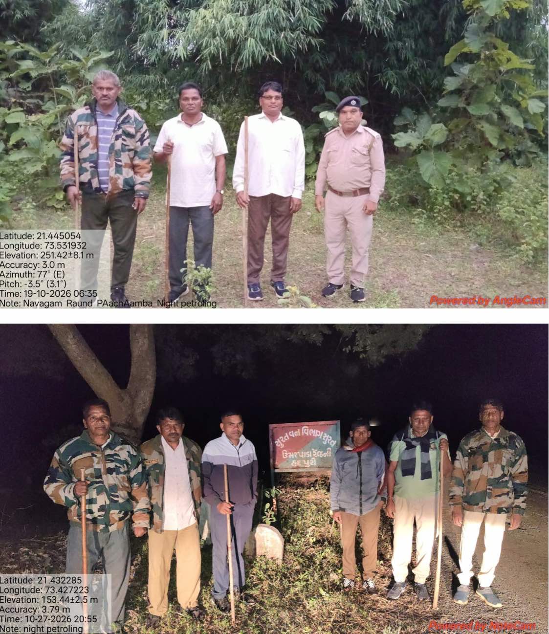
Smartphone applications are being used to capture photographs tagged with latitude, longitude, elevation, positional accuracy and timestamps. These geotagged photographs create location-specific digital records of activities and incidents.
For example, when personnel encounter illegal tree felling, encroachment, unauthorised cultivation, forest fires or grazing-related issues, they can document the incident with precise geographical coordinates.
Similarly, plantation sites, check dams, gabions, van talavs, boundary trenches and percolation ponds can be documented through photographs taken at their actual locations.
Before-and-after photographs also help officers assess the condition of completed works and verify whether the intended interventions have been carried out.
Patrol routes and geotagged photographs provide additional information about areas covered by field personnel, helping officers identify locations that may require more attention.
This system does not eliminate physical inspections. Instead, it enables officers to plan their visits better, identify priority locations and maintain more consistent records.
Benefits for Common People: Better Forests, Better Livelihoods
Although the initiative is primarily focused on improving technical and administrative processes within the Forest Department, its benefits extend beyond the department.
Lodha acknowledged that the direct connection with the common public may not always be immediately visible because much of the work involves technical forest management. However, he emphasised that improving the efficiency of field personnel ultimately strengthens forest protection.
“Our field staff also work in difficult conditions. We are trying to use technology to make their work easier and more efficient. Once they learn these tools, they can use them for several purposes, including wildlife assessment, monitoring encroachment and identifying changes in forest areas,” he said.
He explained that satellite imagery can help personnel monitor large forest areas without having to physically visit every location repeatedly.
“For example, if someone is responsible for 2,000 hectares of forest, it is not possible to visit every location manually all the time. But if the person has a digital map on a smartphone, they can monitor changes over the years. If there is any cutting or encroachment, they can identify the location and take action quickly,” he added.
For ordinary citizens, the larger benefit comes from better-protected forests. Healthy forests support cleaner air, water conservation, soil protection, biodiversity and climate resilience.
More efficient plantation planning and conservation work can also help reduce environmental degradation and contribute to the long-term protection of natural resources on which communities depend.
Improving Accountability and Resource Utilisation
The integration of digital tools is also changing the administrative functioning of the Division.
Officers can examine digital maps before visiting plantation sites, locate conservation structures through their coordinates and review field information without depending entirely on manually maintained records.
The system also strengthens transparency. Coordinates, timestamps and geotagged photographs provide additional means of verifying reported activities and assessing completed works.
Better planning helps ensure that resources are utilised according to the actual requirements of a particular landscape. Plantation, fencing, contour trenches and water-harvesting structures can be coordinated rather than implemented as isolated activities.
Another important advantage is the creation of a long-term digital database. The Division can compare satellite imagery and geographical records over five or ten years to assess changes in forest cover, plantation survival and other landscape-related developments.
This will help officers evaluate the effectiveness of interventions and identify areas requiring further attention.
Towards a Technology-Driven Future
The Surat Forest Division is gradually building a digital information base covering plantation plots, compartment boundaries, conservation structures and forest offence locations.
The technologies being adopted are largely based on accessible smartphone applications and established geospatial platforms, making them practical for routine departmental use.
For Gaurav Lodha, the larger objective is to ensure that technology does not remain restricted to senior officers or specialised technical teams but becomes an integral part of everyday forest administration, reaching personnel at the beat level.
As he puts it, the aim is to make forest management faster to plan, easier to monitor and more efficient to execute.
By combining AI-assisted planning, geospatial mapping, GPS-based monitoring and frontline capacity building, Surat Forest Division is demonstrating how relatively accessible technology can strengthen traditional forest governance.
It is not simply about bringing artificial intelligence into the forest. It is about equipping the people protecting India’s forests with better tools, more reliable information and the ability to make timely, informed decisions.