When wild animals enter human settlements, the immediate response is often to capture or relocate them. But in the forests surrounding Tirupati, the problem required a wider approach: understanding why animals were moving towards people, reducing the factors attracting them and helping residents respond safely when encounters occurred.
During his tenure in the region, Vivek, a 2019-batch Indian Forest Service officer of the Andhra Pradesh cadre, worked on several aspects of this challenge. The interventions addressed leopard movement around pilgrimage routes and educational institutions, elephant-related risks in villages, and the need for better coordination between forest officials and other departments.
IFS officer Vivek is currently serving as Regional Officer of the Andhra Pradesh Forest Development Corporation in the Nellore Region. His experience in the Tirupati landscape offers an account of how human-wildlife conflict management extended beyond forest boundaries and into the everyday lives of pilgrims, farmers and residents.
How Food Waste Was Drawing Leopards Towards Alipiri
The Alipiri footpath, used by thousands of pilgrims travelling on foot to Tirumala, faced a recurring challenge: food waste left along the route attracted herbivores, which could then draw predators closer to people.
To address this, around 20 animal-proof steel bins, each with a capacity of approximately 1.2 tonnes, were installed along the footpath. The bins were procured through Chennai Port, and the Tirumala Tirupati Devasthanams (TTD) Health Department cleared the waste every 48 hours.
The aim was to prevent discarded food from becoming an easy source of nutrition for wildlife and to reduce the congregation of herbivores near the walkway. Forest staff also carried out parallel patrolling on both sides of the footpath.
According to monitoring figures shared by Mr Vivek, leopard presence along the route fell to around 10–20 per cent of its earlier peak.
The intervention highlighted how a seemingly routine issue such as waste disposal could influence wildlife movement. When food waste attracts prey animals, predators may follow. Reducing those attractants can therefore help limit encounters without relying solely on capturing or relocating animals.
Pilgrims were also advised not to leave food or leftovers along the Alipiri and Srivari Mettu routes and to carry their waste to designated disposal points.
Extending the Strategy Beyond the Pilgrimage Route
Leopard movement was also reported around the Sri Venkateswara University (SVU) campus, the perimeter of Sri Venkateswara Zoological Park and Zoo Park Road. Addressing the issue required attention to the conditions around these locations, not just the forest from which the animals emerged.
Unmanaged waste could attract stray dogs and wild boars, creating a source of prey for leopards near human settlements. Dense undergrowth and accumulated debris could also make it harder to monitor animal movement around the forest fringes.
During Mr Vivek’s tenure, the forest authorities coordinated with the Tirupati Municipal Commissioner on sanitation and the clearing of bushes and undergrowth in identified areas. The work extended beyond one-time clean-ups, with weekly reviews and monitoring of debris to help keep the areas clear.
The issue of dogs being abandoned near the forest edge was also addressed. Measures were taken to stop the practice, and stray dogs found in vulnerable locations were systematically captured and relocated where required. Mr Vivek reported that the abandonment of dogs near the forest edge had stopped for six months during the period discussed.
NCC cadets and local youth also participated in cleaning and awareness efforts, extending the work beyond forest staff and municipal teams.
Leopards found in areas of concern were captured and relocated where necessary. However, the wider strategy recognised that relocation alone could not prevent further encounters if the conditions attracting animals remained unchanged. Waste management, control of prey attractants, vegetation clearance and regular monitoring all formed part of the response.
Building a Coordinated Response to Elephant Movement
Elephant movement posed a different challenge. Unlike an isolated leopard sighting, an elephant herd moving through agricultural land could affect several villages, damage crops and put residents at risk.
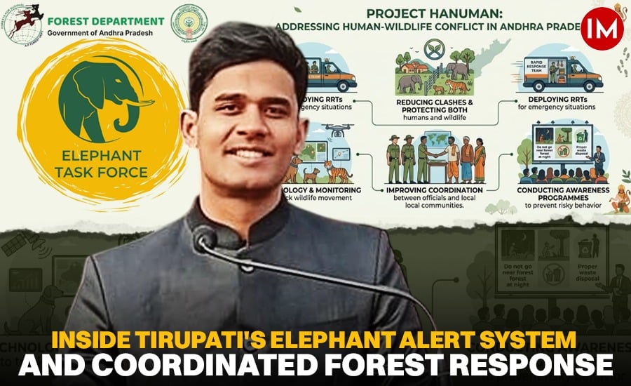
To improve coordination, an Elephant Task Force was established in Tirupati, supported by a joint command-and-control room at a biolab facility. The system linked the Collectorate and Superintendent of Police control rooms in Tirupati, Chittoor and Annamayya districts.
Departments dealing with Panchayati Raj, agriculture, horticulture and electricity were brought into the coordination framework. The aim was to ensure that information about elephant movement and the resulting risks could reach the departments responsible for responding on the ground.
The effort also relied on a network of approximately 70–80 elephant trackers and Vana Mithras, who helped monitor movement and communicate information from affected areas.
Mr Vivek explained the principle behind this approach: “We cannot control wild elephant behaviour through commands; we can only control human behaviour through established protocol and law enforcement.”
The distinction was important. Wild elephants could not be expected to follow human instructions, but people could be given timely information and guidance to reduce dangerous encounters.
GAJA App and Mobile Alerts for Villages
Technology was another part of the response. The GAJA App, launched on World Elephant Day, brought stakeholders involved in crop-damage compensation into a common system, with defined timelines intended to improve the handling of claims.
For residents in areas vulnerable to elephant movement, the focus was also on receiving warnings before encounters occurred.
Through the Real Time Governance Society (RTGS), geofenced SMS alerts were designed to reach mobile phones within a five-kilometre radius of a reported elephant location. Alerts were intended to reach people by around 4 pm, giving them time to plan their activities before dusk.
Residents were advised to avoid going into fields after dark when elephant movement posed a risk.
These measures connected information about wildlife movement with practical decisions at the village level. An alert was useful not merely because it reported an elephant’s presence, but because it gave people time to change their plans.
When Capture and Relocation Were Necessary
Prevention and early warnings could reduce risk, but some situations still required direct intervention.
Kumki elephants maintained at the Palamaner camp were used in selected high-conflict cases. One example discussed by Mr Vivek involved a bull elephant identified as HEC-1, which had caused a human fatality at Bakarapet.
The management response also required distinguishing between elephants that regularly occupied the Seshachalam landscape and those moving into the region from fragmented habitats with a history of high conflict. Different movement patterns and levels of risk called for different responses.
Understanding where an elephant came from, how it moved and what circumstances brought it close to people was therefore relevant to deciding how to manage a particular case.
Using Surveys and Data to Understand Wildlife
Conflict management was not limited to immediate threats. Forest officials also worked on gathering information that could support longer-term conservation and planning.
A systematic census of the Grey Slender Loris involved five months of nocturnal surveys and produced an estimated population of 419. A conservation plan was subsequently released through Andhra Pradesh Deputy Chief Minister Pawan Kalyan.
The work reflected the importance of field surveys in landscapes where wildlife populations and movement patterns needed to be better understood. Data could help officials move beyond isolated sightings and make more informed decisions about conservation priorities.
The development of AI-supported mapping and data analysis was another part of the effort to improve understanding of wildlife movement and identify areas requiring attention.
Coexistence Requires Action Beyond the Forest
The experience of the Tirupati region showed that human-wildlife conflict could not be addressed by forest staff alone. Waste disposal along pilgrimage routes, abandoned dogs near forest edges, crop protection, electricity infrastructure and the timing of agricultural activity all influenced the risks faced by people and animals.
The interventions during Mr Vivek’s tenure brought together several layers of response: reducing food waste, patrolling vulnerable routes, coordinating departments, issuing mobile alerts, supporting compensation processes and using field surveys to improve understanding of wildlife.
No single measure could eliminate encounters with wild animals. But identifying what attracted them towards people, improving communication and helping residents respond before a situation escalated could reduce the risks.
For a landscape where forests, settlements, farms and pilgrimage routes meet, coexistence depended on managing these shared spaces with greater care. The experience also underlined a central point in wildlife management: protecting people and conserving animals are not separate responsibilities. Both depend on understanding why encounters happen and acting before they turn into conflict.