A tiger disappears into a sugarcane field. The crop is nearly 10 feet high. The field stretches across 50 or even 60 acres. From the ground, there is no way to know where the animal is resting.
For a forest team, this can become a dangerous situation within minutes.
At Valmiki Tiger Reserve in Bihar, such challenges became more frequent as the tiger population recovered. The rise was a major conservation success. But it also meant that young tigers began dispersing beyond protected forests and entering agricultural landscapes.
It was here that Pradyumn Gaurav, a 2016-batch Indian Forest Service officer of the Bihar cadre, worked on a different approach. He is currently serving as Divisional Forest Officer (DFO), Bhojpur Forest Division. During his earlier field experience at Valmiki Tiger Reserve, he helped develop a system that combined thermal drones, GPS-based monitoring, traditional tracking and community coordination.
The aim was simple: know where the tiger is before people encounter it.
WHEN CONSERVATION SUCCESS CREATED A NEW CHALLENGE
Tiger numbers in Valmiki had increased almost sevenfold, from just eight in 2010 to 54 in 2022 and close to 60 by 2023. But the landscape around the reserve was complicated. The eastern part of Valmiki Tiger Reserve Division-I narrows into an ecological corridor surrounded by villages and large agricultural fields. Sugarcane became particularly challenging. Its dense growth provides cover similar to a forest.
As sub-adult tigers moved out in search of new territories, they often entered these fields.
“The primary challenge was not simply locating a tiger. It was locating it without putting either the animal or our people at unnecessary risk. Traditional pugmark tracking could tell us that a tiger had passed through an area, but it could not tell us where the animal was hiding at that moment,” says Pradyumn Gaurav.
Forest teams were already working extensively on the ground. Around 90 patrol teams were recording nearly 50,000 foot-kilometres every month through M-STrIPES.
Yet a person walking into tall sugarcane could unknowingly come face-to-face with a tiger.
TAKING THE BLIND SPOT OUT OF TRACKING
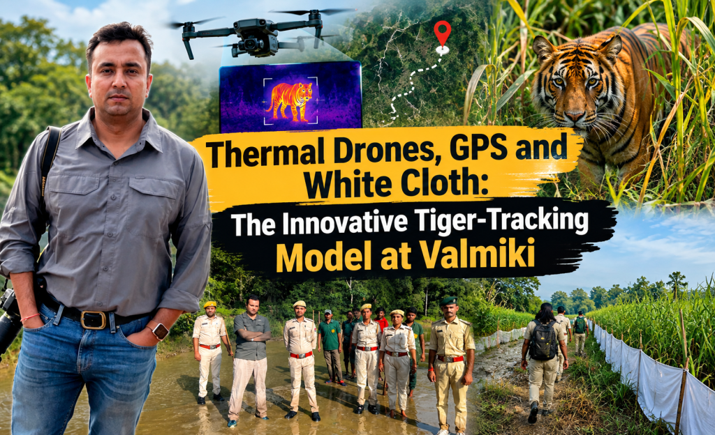
Thermal drones changed this equation. The drones detect infrared heat signatures. A tiger’s warm body stands out against the cooler crop, soil and surrounding landscape. For the field team, this meant a major shift. Instead of searching an entire 60-acre field, they could identify the specific patch where the tiger was resting. They could confirm whether it was a single animal or more than one. They could also track movement during low-light conditions.
“The thermal drone gave our teams something we did not have earlier — visibility inside dense crops. Once we knew the exact location of the tiger, the response could become precise rather than reactive,” Gaurav explains. This also reduced unnecessary disruption to villages. Instead of restricting an entire village, teams could focus on a small one- or two-acre area around the animal.
A RESPONSE BUILT AROUND AN OPEN EXIT
Technology was only one part of the system. Once a tiger was detected, teams followed a structured Standard Operating Procedure. Field teams first checked for fresh pugmarks before sunrise. The Range Officer, DFO and Field Biologist were alerted. GPS coordinates were mapped against the tiger’s known range.
Then came an unusual but simple technique — the use of long white cloth sheets. The team created a visual cordon around the tiger while leaving an opening towards the forest, river or natural scrub. The idea was not to trap the animal. It was to guide it.
“The principle was to never corner the tiger. We wanted to keep an open exit towards natural habitat so that the animal could move away on its own. Technology helped us know where it was, while the cordon helped us manage its movement safely,” says Gaurav.
As the tiger moved, the teams moved the cordon with it. Anti-snare teams simultaneously checked the surrounding crops for traps and illegal electric fencing. Rapid Response Teams managed village roads and guided people away from the animal’s immediate path.
THE LONG MARCH OF TIGER T136
One of the clearest examples of this approach came in July 2024. A young male tiger, identified as T136, moved out of the Manguraha Range on 11 July. It travelled south through the Birahaa river basin, crossing agricultural areas and human-dominated landscapes. The tiger eventually moved towards Chanpatiya near Bettiah.
For nearly 22 to 24 days, T136 remained outside protected forest limits. It travelled more than 125 kilometres through 13 major revenue villages. It survived largely on nilgai and wild boar.
A team of around 20 forest personnel tracked it round the clock. They walked more than 150 kilometres through rivers, sugarcane and paddy fields. Thermal drones provided regular location updates. The white-cloth cordon was then placed along settlement edges, while an open route was kept towards natural areas.
Eventually, T136 reached the agricultural limits near Bettiah. With no continuous forest available ahead, it began moving back north. On 4 August, it safely crossed into Nepal’s Parsa National Park. The operation ended without human injuries, livestock attacks or harm to the tiger.
FROM REACTIVE RESPONSE TO PREDICTIVE ACTION
The experience changed the way field teams approached tiger dispersal. Earlier, teams often responded after receiving an emergency call. Crowds would gather. The animal could become stressed. The risk of a rushed capture increased.
The new system created clearly defined roles. Drone operators tracked the animal. Ground teams monitored its movement. Other teams managed the cordon and village access. Anti-snare teams checked the animal’s route.
GPS data also helped teams understand movement patterns, watering points and kill sites. “The biggest change was the confidence of the field team. They were no longer entering tall sugarcane without knowing what was ahead. Every movement was planned around real-time information,” says Gaurav.
TECHNOLOGY ALSO BUILT TRUST
For communities living around Valmiki, however, technology had another benefit. It made communication more precise. Instead of issuing broad warnings, forest officials could tell villagers exactly where the tiger was resting and which areas should be avoided.
This helped reduce fear and rumours. During one such operation, farmers told the team that they normally spent nights on wooden watchtowers protecting their crops from wild herbivores. When a tiger occupied the area, however, animals such as nilgai and wild boar stayed away.
The farmers could therefore return home at night, confident that the forest teams were monitoring the tiger. For Gaurav, this trust is an important part of conservation.
“A conflict-management system succeeds only when local people believe that the Forest Department knows what it is doing. The drone, GPS and response protocol gave us better information, but community trust gave us the space to use that information effectively,” he says.
The protocol was subsequently published on Global Tiger Day 2025 in STRIPES magazine of the Ministry of Environment, Forest and Climate Change and recognised in the National Tiger Conservation Authority‘s M-STrIPES publication.
At Valmiki, the lesson is clear. Technology does not replace people, field knowledge or traditional wisdom. It makes them work together. And when a tiger disappears into a vast sugarcane field, knowing exactly where it is can make the difference between a dangerous encounter and a safe return to the wild.
Also Read – How One Forest Officer Used Science, Cyber Intelligence and Law to Take on Tiger Poaching