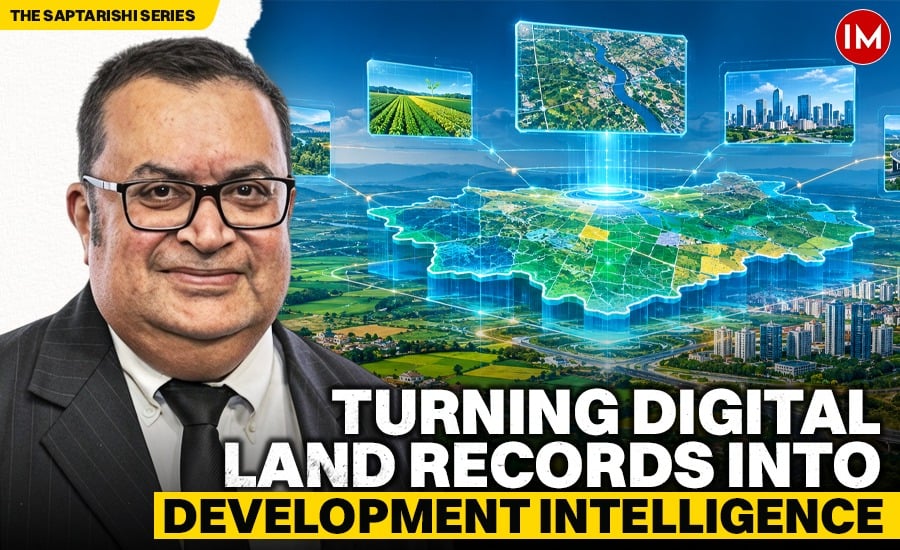
THE SAPTARISHI SERIES — BHARADVĀJA LAYER
India’s land-record modernisation has entered a different phase. The question is no longer whether records can be digitised at scale. Increasingly, they can. The more important question is whether the different pieces of land information can be trusted together when a real planning, infrastructure or development decision has to be made.
That distinction matters.
In September 2026, the Government of India launched the operational guidelines for DILRMP 3.0, the next phase of the Digital India Land Records Modernisation Programme. The programme explicitly moves toward an integrated, GIS-based “Land Stack”, universal Bhu-Aadhaar or ULPIN for land parcels, full georeferencing of cadastral maps, modernised registration services, digital repositories of registered deeds and encumbrance information, paperless revenue courts, and expansion of urban land mapping through NAKSHA.
This is a significant evolution. By August 2026, the Department of Land Resources reported that more than 40.58 crore land parcels had already been assigned ULPINs. At the end of 2025, the Department reported computerisation of Records of Rights in 97.27% of villages, digitisation of cadastral maps across 97.14% of the country, and integration of textual records with maps in 84.89% of villages.
India is therefore not starting from zero. It is entering the harder stage: moving from digitised records to dependable institutional coherence.
A digital record is not automatically a decision-ready record
A planner considering a new road, a development authority reviewing a major project, a bank examining collateral, or an infrastructure agency assessing a corridor does not ask only one question about land.
They may need to know where a parcel begins and ends, who holds rights over it, whether a mutation has been recorded, whether an encumbrance exists, what planning controls apply, whether an acquisition or right-of-way affects it, and whether the information being relied upon is current.
Read Also: Tribal Tourism Takes Root: Bringing Visitors Closer to Tribal Life, Culture and Nature
Much of this information may already be digital.The difficulty begins when different digital records describe the same physical parcel differently, are updated at different times, sit within different institutional systems, or cannot be confidently related to one another.
This is the difference between digitisation and coherence.
Digitisation makes records easier to store, retrieve and transmit. Coherence allows different institutions to make decisions from a sufficiently consistent understanding of the same physical reality.
India’s next land-governance challenge is increasingly about the second.
Why the cadastre matters beyond the revenue department
The cadastre is sometimes understood narrowly as a land-record or revenue function. In reality, a dependable cadastral foundation influences almost every part of the built environment.
A boundary discrepancy can become a planning problem.
An unresolved mutation can become a transaction problem.
A road reservation can become an infrastructure problem.
A mismatch between textual ownership and spatial mapping can become a financing or due-diligence problem.
An outdated parcel description can become an approval problem.
In a rapidly urbanising economy, these are not separate administrative inconveniences. They are different manifestations of the same underlying issue: multiple institutions are making decisions about one physical asset—the land parcel—without always working from one sufficiently reliable frame of reference.
The constitutional reality is also important. Land is a State subject in India. Any national digital ambition therefore has to work with federal diversity rather than pretend it does not exist. A stronger cadastral backbone should not mean replacing state systems with one monolithic database. The more useful question is whether different systems can become sufficiently legible to one another while states retain their statutory roles and administrative control. That is a governance question as much as a technology question.
ULPIN is a major step—but identity is only the beginning
The Unique Land Parcel Identification Number, or Bhu-Aadhaar, is one of the most important developments in this transition. A stable parcel identity creates the possibility of referring consistently to the same land parcel across time and across different administrative processes. That matters because ambiguity begins when one physical parcel is represented differently across records or systems. But identity on its own is not the same as institutional understanding.
A parcel number can tell systems which parcel they are referring to. It does not, by itself, ensure that every institution sees the same current boundary, planning condition, legal status or development context. The next step is therefore not simply to assign identity, but to strengthen the reliability of the information that gathers around that identity.
This is where the policy direction of DILRMP 3.0 becomes especially significant. Full georeferencing, the proposed registration repository, better integration of revenue and registration systems, urban land mapping through NAKSHA, and digitally linked revenue-court processes all point toward a land-information environment that is more connected than the first generation of digitisation. The opportunity now is to ensure that this connection becomes useful to the wider development system.
From land records to development intelligence
Within the Saptarishi Framework, I describe this institutional problem through the Bharadvāja Layer. Bharadvāja is the land, revenue and cadastre layer of the framework. Its purpose is not to replace DILRMP, ULPIN, NAKSHA, state land-record systems or the constitutional role of state governments.
It asks a different question: Can the land information already being modernised become a dependable institutional foundation for the decisions that shape the built environment? That means thinking beyond access to individual records. For a development authority, the relevant test is whether parcel information can support planning judgment.
For an infrastructure owner, it is whether corridor, boundary and land-status information can be relied upon early enough to affect project decisions. For a municipal institution, it is whether the land on which an approved asset sits can remain consistently identifiable through later stages of development and operation.
For an investor or lender, it is whether the information surrounding an asset remains sufficiently dependable to support due diligence. These are not arguments for placing every piece of information in one database. Nor do they require every agency to surrender control of its own statutory records. They require something more fundamental: a shared confidence that when different institutions refer to the same parcel, they are actually talking about the same place.
Urban India makes the question more urgent
The challenge becomes sharper in urban areas because land information is asked to carry more institutional meaning. The same parcel can sit simultaneously inside a planning zone, a road-widening proposal, a utility network, a flood-risk area, a development-control regime, a property-tax system and a private transaction.
NAKSHA—the National Geospatial Knowledge-based Land Survey of Urban Habitations—shows that the Government already recognises the need for more accurate, GIS-based urban land records. By the end of 2025, aerial surveys had been completed across 116 urban local bodies, covering nearly 5,915 square kilometres, with ground-truthing progressing in many locations.
That is important progress. But the larger opportunity is not simply better maps. It is whether better maps and better records can reduce the number of times citizens, institutions and projects have to rediscover, reconcile or reinterpret the same parcel information. A mature digital cadastre should make land more legible to governance.
The next question is readiness
India has already done much of the difficult work required to establish digital land records at national scale. DILRMP 3.0 suggests that policy is now moving toward the next generation of integration. The Bharadvāja proposition is therefore less about inventing another platform and more about testing institutional readiness.
Can textual and spatial records remain aligned?
Can the identity of a parcel survive across different government processes?
Can planning and development decisions rely on the information without repeatedly reconstructing its context?
Can the information remain useful as the parcel moves from ownership to approval, infrastructure, finance and long-term urban governance?
The detailed institutional and technical answers to those questions will necessarily vary across states, cities and agencies. They should.
What should not vary is the ambition for reliable land information.
For India’s next phase of urbanisation and infrastructure growth, the land parcel cannot remain merely a record to be retrieved.
It must become a trustworthy point of reference around which institutions can make better decisions.
So the practical question for every organisation dealing with land and development is this:
How confidently can it connect land ownership, planning, approvals and development information without repeatedly reconciling conflicting records?
About The Author – (Apurva Pathak is a New Zealand-based architect, design manager, and built-environment governance
practitioner with more than three decades of experience across India, the Gulf, Africa, Papua New Guinea, and New Zealand. He is the author of the Saptarishi Framework, a proposed seven-layer Digital Public Infrastructure architecture for India’s built environment, integrating BIM, GIS, land governance, municipal automation, digital twins, environmental intelligence, and resilience planning.)
Disclaimer—(The views and opinions expressed in this article are solely those of the author and do not necessarily reflect the views of Indian Masterminds. For feedback or queries, please write to [email protected].)
Read Also: Why Does India Continue to Lose So Many Lives on Its Roads?