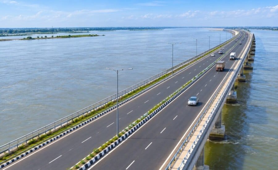
Patna: Bihar is planning a 354.37-km four-lane road along the eastern and western embankments of the Kosi River, in a proposed project aimed at improving connectivity across the state’s flood-prone Kosi belt.
The proposed corridor will connect several towns and rural areas with five national highways and also provide a link to the Gorakhpur-Siliguri Expressway. The project is expected to strengthen road access across parts of north Bihar, particularly areas where movement is frequently affected during the monsoon and flood season.
The proposed alignment follows a study conducted by the Water Resources Department and is planned as two major stretches along the Kosi embankments.
354-Km Road Along Both Kosi Embankments
The proposed Kosi corridor will have separate road stretches on the eastern and western sides of the river.
The eastern embankment section will be around 124 km, while the western embankment stretch will cover approximately 230 km. Together, the two sections will span about 354.37 km.
The eastern stretch is proposed to run from Birpur in Supaul towards Koparia in Saharsa, while the western stretch will connect Birpur with Kursela in Katihar.
The alignment has been planned along the existing Kosi embankments, creating a continuous road corridor through several parts of the region.
Read Also: From AI to 20,477 Placements: Bihar’s Government Technical Colleges Gain Momentum
Proposed Alignment Across North Bihar
The eastern embankment road is proposed to pass through several important locations before reaching Koparia.
The route includes Birpur, Basantpur, Saraigarh, Kishanpur, Nauhatta, Mahishi and Simri Bakhtiyarpur.
On the western side, the proposed alignment will run from Birpur through Bharda, Kunauli, Ghoghardiha, Madhepur, Marauna, Kiratpur, Alauli, Chautham and Naugachhia, before reaching Kursela.
The proposed route would therefore connect a number of settlements that currently depend on different road corridors for access to nearby towns and major highways.
Project May Require Large Land Area
The proposed corridor is expected to require around 94,200 acres of land.
Of this, approximately 34,700 acres have been indicated for the eastern embankment section, while around 59,500 acres are proposed for the western section.
The land requirement will be an important part of the project’s future planning and implementation. Further administrative and technical processes would be required before construction can move ahead.
Eight Districts to Benefit
The proposed Kosi road is expected to improve connectivity across several districts and the wider Kosi region.
The project details identify Supaul, Madhepura, Bhagalpur, Madhubani, Darbhanga, Katihar and Khagaria, along with the wider Kosi belt, among the areas expected to benefit.
For people living in villages and smaller settlements along the proposed corridor, an additional four-lane route could provide easier access to urban centres, markets and existing highways.
The corridor could also create an alternative movement route in areas where road travel becomes difficult during periods of heavy rainfall and flooding.
Five National Highways to Connect With Kosi Corridor
One of the key features of the proposed Bihar Kosi four-lane road is its planned integration with five national highways.
These include:
- NH-231, connecting Darbhanga and Saharsa
- NH-27, connecting Madhubani and Supaul
- NH-31, connecting Bhagalpur and Katihar
- NH-527A, connecting Madhubani and Supaul
- NH-131, connecting Darbhanga and Madhubani
The proposed corridor will also connect with the Gorakhpur-Siliguri Expressway, giving the Kosi region a link to a major east-west transport corridor.
Such connections could make it easier for traffic from the Kosi belt to move towards larger highway networks instead of depending only on existing local routes.
A Road Response to Kosi’s Flood Challenges
The Kosi has a long history of flooding and changes in its course, making road connectivity a recurring challenge in parts of north Bihar.
During the monsoon, flooding and waterlogging can disrupt movement between villages and towns and affect access to major roads. The proposed embankment-side corridor is intended to address some of these connectivity challenges by creating a more continuous route along the river.
The road would not eliminate the region’s flood-related difficulties, but its planned alignment could provide an additional transport corridor for communities located along the Kosi belt.
What the Proposed Corridor Could Mean for the Region
If implemented as proposed, the 354.37-km Kosi four-lane corridor could become an important road link for north Bihar.
Its connection with five national highways and the Gorakhpur-Siliguri Expressway could improve the movement of people, goods and services across the region. Better road access could also support local markets, agricultural movement and links between rural settlements and urban centres.
For a region where connectivity can be heavily affected by seasonal flooding, a dedicated corridor along both embankments could add another layer to the existing road network.
The proposal therefore goes beyond building a long stretch of highway. Its larger significance lies in creating stronger links between the Kosi belt, major national highways and a wider regional expressway network.
Read Also: Bihar’s Youth Step Up: Patna Women’s College Pushes Tobacco-Free Campus Drive