The Beas is the river around which Kullu and Manali have grown, but in the summer of 2023, the river revealed how vulnerable that relationship had become.
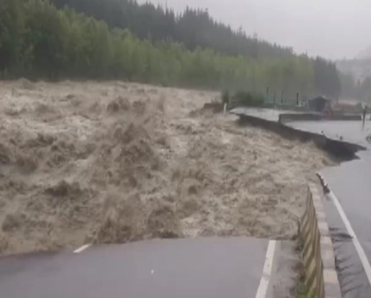
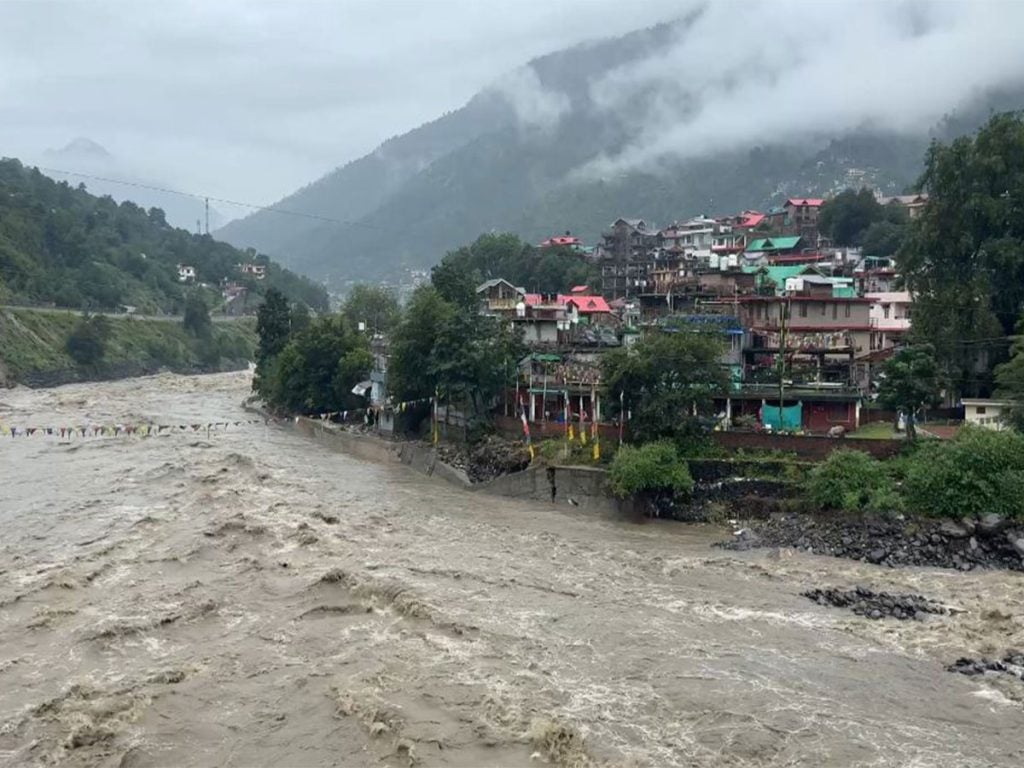
Flash floods tore through the valley, damaging roads, infrastructure and river-side settlements and cutting Kullu-Manali off from the rest of the country. In the aftermath, several committees examined what had gone wrong.
One finding stood out: the riverbed had gradually filled with enormous quantities of boulders, debris and sediment carried downstream over the years. A river channel that should have functioned like a V-shaped drain had, in places, effectively turned into an inverted U. Its central portion was choked. With less room to carry water, the river began pushing its flow towards inhabited areas.
For the 2012 batch, Himachal Pradesh cadre IFS officer Sandeep Sharma, currently posted as Conservator of Forests, Kullu, this was the point at which disaster management and river conservation could no longer be treated as separate subjects.
“The riverbed was completely filled with boulders and debris that had accumulated over time. The carrying capacity had reduced significantly, so when the water came, instead of remaining within the river channel, it was moving towards downstream habitation. That became the trigger for us to start looking at restoration of the river channel,” he shared in an exclusive conversation with Indian Masterminds.
What followed was far more complicated than simply removing debris.
Also read: The Bridge That Rose From the Ruins: How IFS Gurharsh Singh United a Village After the Samej Disaster
A River Project Trapped in a Maze of Laws
Removing material from a riverbed sounds straightforward until the land, the material and its disposal fall under different laws and departments.
The excess material could not simply be dumped elsewhere. Since portions of the area involved forest land, commercial activity and disposal had to comply with forest conservation provisions. At the same time, the operation intersected with disaster management rules, environmental regulations and mining-related procedures.
Four different institutional frameworks had to work together: the Disaster Management Act, forest conservation legislation implemented by the Forest Department and the Ministry of Environment, Forest and Climate Change, the Environment Protection Act, and river/mining rules administered by the Mining Department.
For nearly one-and-a-half years, Sharma and his team worked to bring these systems onto one platform.
“The biggest challenge was not the technical work alone. It was bringing different departments, different laws and different procedures together for an activity that had never been done before in Himachal Pradesh. We had to streamline the entire process, amend rules through Cabinet approval, create new guidelines and establish a district-level mechanism to make the work legally and technically sound,” he shared.
The effort eventually secured the required forest and environmental clearances, along with disaster-management permissions and mitigation measures. The pilot was taken up across 13 hectares.

Dredging the River Without Losing Sight of the Forest
The idea was not to treat dredging as conventional mining. It was to restore the river’s carrying capacity while ensuring that every step was regulated and environmentally accountable.
A detailed Standard Operating Procedure was developed to guide the work. The project also incorporated biodiversity safeguards and compensatory afforestation. Because 13 hectares were diverted under forest conservation provisions, compensatory afforestation over double the area became part of the project.
In other words, clearing the river channel was paired with restoring forest cover elsewhere.
Then came another unusual element: the material removed from the river could generate revenue rather than simply become a disposal problem. The auction process has already begun. Sharma estimates that the 26-hectare pilot could yield around six lakh metric tonnes of material annually, with potential revenue of roughly ₹12–13 crore, depending on actual extraction and auction outcomes.
That creates a remarkable chain of benefits: the river is cleared, flood risk is reduced, forest restoration receives funding, local economic activity is generated and the government earns revenue from material that otherwise would have remained a disaster-management liability.
When Disaster Management Starts Paying for Conservation
Perhaps the most interesting part of the model lies in what happens to the money generated.
A watershed management committee is being created to channel net proceeds towards stabilising the river’s catchment and watershed over the long term. The idea is simple but powerful: money generated from reducing disaster risk can be reinvested into reducing future ecological and disaster vulnerability.
“The objective is not simply to remove material from the river. The revenue generated from this activity will go back into watershed management. Along with compensatory afforestation and biodiversity measures, it can support local livelihoods and help stabilise the catchment. So the same intervention can address disaster risk today while investing in the health of the watershed for the future,” he told Indian Masterminds.
The watershed plan will not be prepared behind closed doors. Local communities are expected to participate directly in deciding where afforestation, rehabilitation and other conservation works should be undertaken.
That makes the model more than an engineering intervention. It becomes a community-linked conservation economy.
From 13 Hectares to 60 Vulnerable Sites
The pilot is only the beginning. Between Kullu and Manali, around 60 vulnerable sites have been identified where similar intervention may be required. The broader plan covers around 200 hectares.
If scaled up, the financial resources flowing into watershed management could become substantial. More importantly, the intention is to keep the river channels clear before they become the setting for another disaster.
The first season of implementation began in May last year, and the next phase is scheduled for the June-September period. The department is now bringing scientific and technical institutions into the process to make implementation more effective.
Monitoring, too, is being strengthened. Earlier, mining-related monitoring was largely handled by the Mining Department. Under the new arrangement, the District Administration, Forest Department, Forest Corporation and Mining Department are all involved, creating a joint monitoring mechanism.
A New Way of Looking at Himalayan Rivers
The Beas project began with a problem created by disaster, but its ambition reaches much further. It asks whether a river can be restored while reducing flood risk, protecting forests, supporting biodiversity, creating livelihoods and generating funds for future conservation.
In Kullu, Sandeep Sharma’s answer has been to bring all of these pieces into the same framework.
“Our aim now is to scale up the effort across the vulnerable sites so that the river channel remains clear, disaster risk is reduced and the resources generated can simultaneously support watershed management and biodiversity conservation. If we can make this work at scale, it can become a practical model for other vulnerable mountain ecosystems as well.”
The Beas once became too full to carry its own water safely. The response, however, is no longer simply about making space for the next flood. It is about making the river, the forest, the watershed and the communities around them part of the same solution.
Also read: Reclaiming the Forest, Restoring the Land: How IFS N Ravisankar Sarma Recovered 100 Hectares in Rohru